Where does the salt come from?
A defining characteristic of ocean water is its relatively high concentration of dissolved salts or salinity. Understanding why the sea is salty begins with knowing how water cycles among its physical states: liquid, vapor, and ice. As a liquid, water dissolves rocks and sediments, and reacts with emissions from volcanoes and hydrothermal vents: this creates a complex solution of mineral salts in our ocean basins. In other parts of the cycle, however, water and salt are incompatible: water vapor and ice are essentially salt free.
Through Earth's history, certain processes - including weathering of rocks, evaporation of ocean water, formation of sea ice - have served to make the ocean salty. These "salinity raising" factors are continually counterbalanced by processes that decrease salinity such as the continuous input of fresh water from rivers, precipitation of rain and snow, and melting of ice.
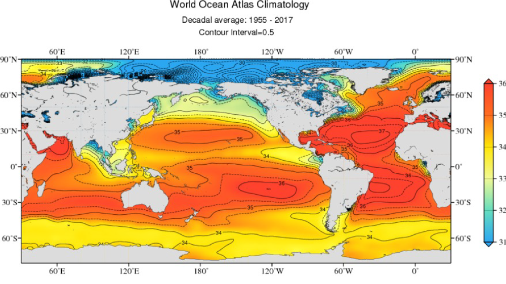
Seafarers through history have discovered that Sea Surface Salinity (SSS) varies from place-to-place: SSS in the open ocean generally ranges between 32 and 37
PSU (practical salinity unit), but may be much lower near fresh water sources or as high as 42 in the Red Sea. Between 300 and 600 AD, awareness of changes in salinity, temperature, and smell helped Polynesians explore the southern Pacific Ocean.
In the 1870s, scientists aboard
H.M.S. Challenger, the scientific expedition that started modern oceanography, systematically measured salinity, temperature, and water density in the world's oceans. Over the years techniques for measuring such ocean water properties have changed drastically in method and accuracy. Aquarius was a NASA Earth Systems Science
Pathfinder mission that provided a new type of SSS measurement through an innovative use of technology.
Although everyone knows that seawater is salty, few know that even small variations in SSS can have dramatic effects on the water cycle and ocean circulation. This is why long-term, accurate,
global maps of SSS - such as those delivered by Aquarius (2011-2015) and the higher resolution SMAP satellite (active since 2015) - are crucial to climate studies. Learn more about NASA's SSS satellites
here.
For a hands on activity exploring this topic, check out:
Recovering Salts from Seawater.