

- HOME
- SCIENCE
- HIGHLIGHTS
- DATA & MAPS
- DATA FOR YOU
- MEETINGS
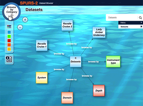
The SPURS-2 field campaign utilized an extensive collection of instruments that took measurements from the water column to the sky. Because of the multidisciplinary nature of these measurements, it is important to identify relationships between the datasets. The SPURS-2 data tool is designed to allow users to interactively explore such relationships. Organized by their commonalities (e.g., depth of measurement, type of instrument, scientific discipline), the information is displayed in a broader context by showing direct connections. The tool also includes instrument descriptions, images, and links to relevant posts from the cruise blog. See the tool in action.
To use the SPURS-2 Data Tool (below):
Note: Efforts are ongoing to complete the production of finalized datasets. When finalized, they will be placed into a permanent archive at the Physical Oceanography Distributed Active Archive Center (PO.DAAC).