Li, Z., Thompson, E., and A., Chen (2023).
The Uncertainty of IMERG Over the Western Edge of the Eastern Pacific Fresh Pool: An Error Model Based on SPURS-2 Field Campaign Observations
, IEEE Trans. Geosci. Remote Sens., 61, 4104914, doi: 10.1109/TGRS.2023.3306795.
Chkrebtii, O., and Bingham, F. (2023).
Automatic Detection of Rainfall at Hourly Time Scales from Mooring Near-Surface Salinity in the Eastern Tropical Pacific
, Artif. Intell. Earth Syst., 2(3), doi: 10.1175/AIES-D-22-0009.1.
Gassen, L., Badewien, T., Ewald, J., Ribas-Ribas, M., and Wurl, O. (2023).
Temperature and Salinity Anomalies in the Sea Surface Microlayer of the South Pacific During Precipitation Events
, J. Geophys. Res. Oceans, 128(6), e2023JC019638, doi: 10.1029/2023JC019638.
Li, Z., Thompson, E., Behrangi, A., Chen, H., and Yang, J. (2023).
Performance of GPCP Daily Products Over Oceans: Evaluation Using Passive Aquatic Listeners
, Geophys. Res. Lett., 50, e2023GL104310, doi: 10.1029/2023GL104310.
Bytheway, J., Thompson, E., Yang, J., and Chen, H. (2023).
Evaluating Satellite Precipitation Estimates Over Oceans Using Passive Aquatic Listeners
, Geophys. Res. Lett., 50(6), e2022GL102087, doi: 10.1029/2022GL102087.
Light, C., Arbic, B., Martin, P., Brodeau, L., Farrar, J.T., Griffies, S., Kirtman, B., Laurindo, L., Menemenlis, D., Molod, A., Nelson, A., Nyadjro, E., O'Rourke, A., Shriver, J., Siqueira, L., Small, R.J., and Strobach, E. (2022).
Effects of Grid Spacing on High-frequency Precipitation Variance in Coupled High-resolution Global Ocean-atmosphere Models
, Clim. Dyn., 59, 2887-2913, doi: 10.1007/s00382-022-06257-6.
Zippel, S., Farrar, J.T., Zappa, C., and Plueddemann, A. (2022).
Parsing the Kinetic Energy Budget of the Ocean Surface Mixed Layer
, Geophys. Res. Lett., 49 (2), e2021GL095920, doi: 10.1029/2021GL095920.
Zippel, S., Farrar, J.T., Zappa, C., Miller, U., St. Laurent, L., Ijichi, T., Weller, R., McRaven, L., Nylund, S., and Le Bel, D. (2021).
Moored Turbulence Measurements using Pulse-Coherent Doppler Sonar
, J. Atmos. Ocean. Technol., 38 (9), 1621–1639, doi: 10.1175/JTECH-D-21-0005.1.
Wills, S.M., Cronin, M.F., and Zhang, D. (2021).
Cold Pools Observed By Uncrewed Surface Vehicles in the Central and Eastern Tropical Pacific
, Geophys. Res. Lett., 48 (10), e2021GL093373, doi: 10.1029/2021GL093373.
Iyer, S. and Drushka, K. (2021).
Turbulence Within Rain-Formed Fresh Lenses During the SPURS-2 Experiment
, J. Phys. Oceanogr., 51 (5), 1705-1721, doi: 10.1175/JPO-D-20-0303.1.
Katsura, S., Sprintall, J., and Bingham, F. (2021).
Upper Ocean Stratification in the Eastern Pacific during the SPURS-2 Field Campaign
, J. Geophys. Res. Oceans, 126 (3), e2020JC016591, doi: 10.1029/2020JC016591.
Iyer, S., Drushka, K., and Rainville, L. (2021).
Estimating Turbulent Kinetic Energy Dissipation Rate Using Microstructure Data from the Ship-towed Surface Salinity Profiler
, J. Atmos. Ocean. Technol., 38 (1), 77-89, doi: 10.1175/JTECH-D-20-0002.1.
Zheng, Z., Harcourt, R., and D’Asaro, E. (2020).
Evaluating Monin-Obukhov Scaling in the Unstable Oceanic Surface Layer
, J. Phys. Oceanogr., 51 (3), 911-930, doi: 10.1175/JPO-D-20-0201.1.
Bingham, F. and Li, Z. (2020).
Spatial Scales of Sea Surface Salinity Subfootprint Variability in the SPURS Regions
, Remote Sens., 12(23), 3996, doi: 10.3390/rs12233996.
Bingham, F., Li, Z., Katsura, S., and Sprintall, J. (2020).
Barrier Layers in a High-Resolution Model in the Eastern Tropical Pacific
, J. Geophys. Res. Oceans, 125(12), e2020JC016643, doi: 10.1029/2020JC016643.
Ho, D. and Schanze, J. (2020).
Precipitation-Induced Reduction in Surface Ocean pCO2: Observations From the Eastern Tropical Pacific Ocean
, Geophys. Res. Lett., 47(15), e2020GL088252, doi: 10.1029/2020GL088252.
Schlundt, M., Farrar, J., Bigorre, S., Plueddemann, A., and Weller, R. (2020).
Accuracy of Wind Observations from Open-Ocean Buoys: Correction for Flow Distortion
, J. Atmos. Ocean. Tech., 37(4), 687-703, doi: 10.1175/JTECH-D-19-0132.1.
Klepp, C., Kucera, P., Burdanowitz, J., and Protat, A. (2020).
OceanRAIN – The Global Ocean Surface-Reference Dataset for Characterization, Validation and Evaluation of the Water Cycle
, In Levizzani, V., Kidd, C., Kirschbaum, D.B., Kummerow, C.D., Nakamura, K., and Turk, F.J. (Eds.), Satellite Precipitation Measurement, 655-674, Springer Nature, Dordrecht.
Umbert, M., Guimbard, S., Ballabrera Poy, J., and Turiel, A. (2020).
Synergy Between Ocean Variables: Remotely Sensed Surface Temperature and Chlorophyll Concentration Coherence
, Remote Sens., 12, 1153, doi: 10.3390/rs12071153.
Reverdin, G., Supply, A., Drushka, K., Thompson, E., Asher, W., and Lourenço, A. (2020).
Intense and Small Freshwater Pools From Rainfall Investigated During Spurs‐2 on 9 November 2017 in the Eastern Tropical Pacific
, J. Geophys. Res. Oceans, 125(2), e2019JC015558, doi: 10.1029/2019JC015558.
Zedler, S., Powell, B., Qiu, B., and Rudnick, D. (2019).
Energy Transfer in the Western Tropical Pacific
, Oceanography, 32(4), 136–145, doi: 10.5670/oceanog.2019.419.
Rutledge, S., Chandrasekar, V., Fuchs, B., George, J., Junyent, F., Dolan, B., Kennedy, P., and Drushka, K. (2019).
SEA-POL Goes to Sea
, Bull. Amer. Meteor. Soc., 100(11), 2285-2301, doi: 10.1175/BAMS-D-18-0233.1.
Kuhner, J. (2019).
Automating the Detection of Precipitation and Wind Characteristics in Navy Ocean Acoustic Data
, In OCEANS 2018 MTS/IEEE Charleston, doi: 10.1109/OCEANS.2018.8604693.
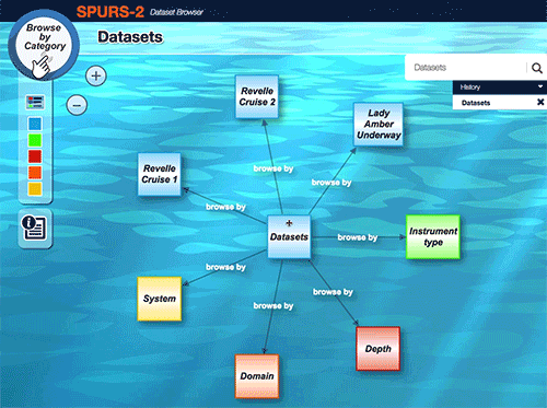
Bingham, F.M., Tsontos, V., deCharon, A., Lauter, C.J., and Taylor, L. (2019).
The SPURS-2 Eastern Tropical Pacific Field Campaign Data Collection
, Oceanography, 32 (2), 142-149, doi: 10.5670/oceanog.2019.222.
Li, Z., Bingham, F.M., and Li, P.P. (2019).
Multiscale Simulation, Data Assimilation, and Forecasting in Support of the SPURS-2 Field Campaign
, Oceanography, 32 (2), 134-141, doi: 10.5670/oceanog.2019.221.
Zhang, D., Cronin, M.F., Meinig, C., Farrar, J.T., Jenkins, R., Peacock, D., Keene, J., Sutton, A., and Yang, Q. (2019).
Comparing Air-Sea Flux Measurements from a New Unmanned Surface Vehicle and Proven Platforms During the SPURS-2 Field Campaign
, Oceanography, 32 (2), 122-133, doi: 10.5670/oceanog.2019.220.
Rainville, L., Centurioni, L.R., Asher, W.E., Clayson, C.A., Drushka, K., Edson, J.B., Hodges, B.A., Hormann, V., Farrar, J.T., Schanze, J.J., and Shcherbina, A.Y. (2019).
Novel and Flexible Approach to Access the Open Ocean: Uses of Sailing Research Vessel Lady Amber During SPURS-2
, Oceanography, 32 (2), 116-121, doi: 10.5670/oceanog.2019.219.
Asher, W.E., Drushka, K., Jessup, A.T., Thompson, E.J., and Clark, D. (2019).
Estimating Rain-Generated Turbulence at the Ocean Surface Using the Active Controlled Flux Technique
, Oceanography, 32 (2), 108-115, doi: 10.5670/oceanog.2019.218.
Shcherbina, A.Y., D'Asaro, E.A., and Harcourt, R.R. (2019).
Rain and Sun Create Slippery Layers in the Eastern Pacific Fresh Pool
, Oceanography, 32 (2), 98-107, doi: 10.5670/oceanog.2019.217.
Clayson, C.A., Edson, J.B., Paget, A., Graham, R., and Greenwood, B. (2019).
Effects of Rainfall on the Atmosphere and the Ocean During SPURS-2
, Oceanography, 32 (2), 86-97, doi: 10.5670/oceanog.2019.216.
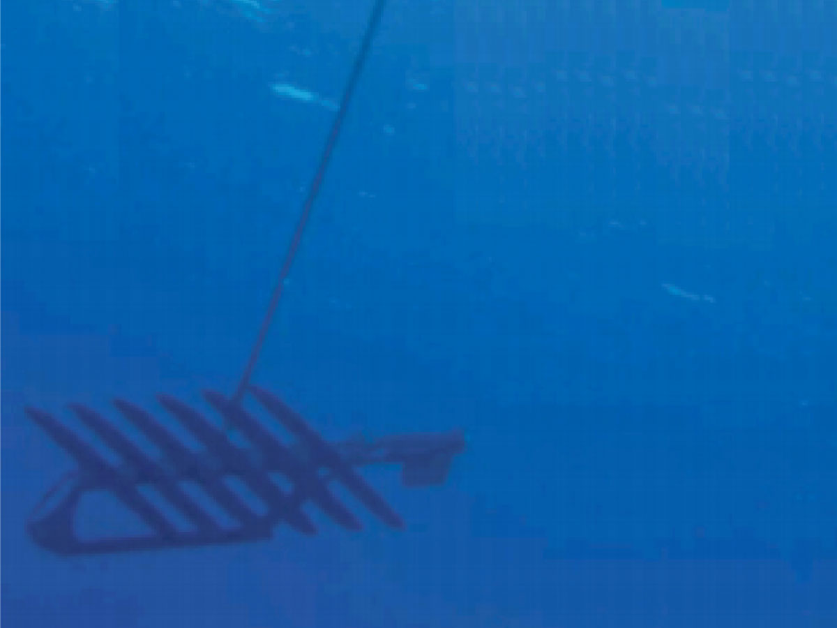
Drushka, K., Asher, W.E., Jessup, A.T., Thompson, E.J., Iyer, S., and Clark, D. (2019).
Capturing Fresh Layers with the Surface Salinity Profiler
, Oceanography, 32 (2), 76-85, doi: 10.5670/oceanog.2019.215.
Volkov, D.L., Dong, S., Foltz, G.R., Goni, G., and Lumpkin, R. (2019).
Observations of Near-Surface Salinity and Temperature Structure with Dual-Sensor Lagrangian Drifters During SPURS-2
, Oceanography, 32 (2), 66-75, doi: 10.5670/oceanog.2019.214.
Thompson, E.J., Asher, W.E., Jessup, A.T., and Drushka, K. (2019).
High-Resolution Rain Maps from an X-band Marine Radar and Their Use in Understanding Ocean Freshening
, Oceanography, 32 (2), 58-65, doi: 10.5670/oceanog.2019.213.
Rutledge, S.A., Chandrasekar, V., Fuchs, B., George, J., Junyent, F., Kennedy, P., and Dolan, B. (2019).
Deployment of the SEA-POL C-band Polarimetric Radar to SPURS-2
, Oceanography, 32 (2), 50-57, doi: 10.5670/oceanog.2019.212.
Riser, S.C., Yang, J., and Drucker, R. (2019).
Observations of Large-Scale Rainfall, Wind, and Sea Surface Salinity Variability in the Eastern Tropical Pacific
, Oceanography, 32 (2), 42-49, doi: 10.5670/oceanog.2019.211.
Sprintall, J. (2019).
Upper-Ocean Salinity Stratification During SPURS-2
, Oceanography, 32 (2), 40-41, doi: 10.5670/oceanog.2019.210.
Farrar, J.T. and Plueddemann, A.J. (2019).
On the Factors Driving Upper-Ocean Salinity Variability at the Western Edge of the Eastern Pacific Fresh Pool
, Oceanography, 32 (2), 30-39, doi: 10.5670/oceanog.2019.209.
Melnichenko, O., Hacker, P., Bingham, F.M., and Lee, T. (2019).
Patterns of SSS Variability in the Eastern Tropical Pacific: Intraseasonal to Interannual Timescales from Seven Years of NASA Satellite Data
, Oceanography, 32 (2), 20-29, doi: 10.5670/oceanog.2019.208.
Lindstrom, E.J., Edson, J.B., Schanze, J.J., and Shcherbina, A.Y.
(2019).
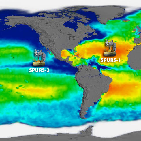
SPURS-2: Salinity Processes in the Upper-Ocean Regional Study 2 - The Eastern Equatorial Pacific Experiment
, Oceanography, 32 (2), 15-19, doi: 10.5670/oceanog.2019.207.
St. Laurent, L.C., and Merrifield, S.T. (2017).
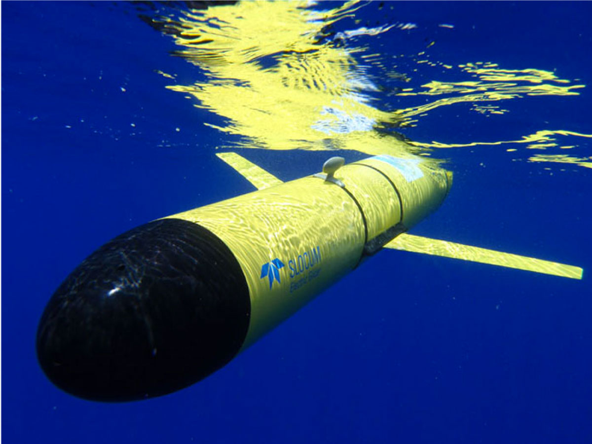
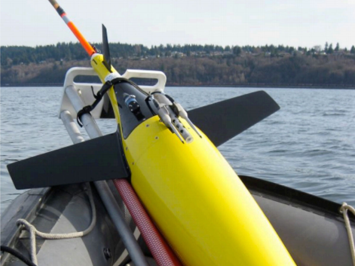
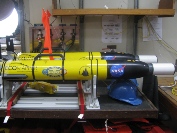
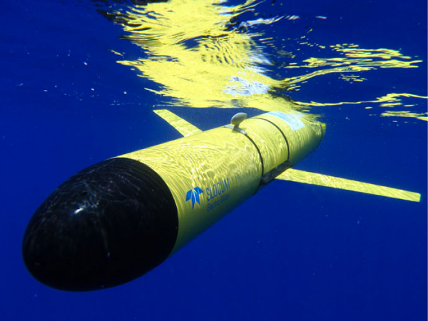
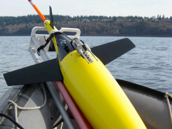
Measurements of Near-Surface Turbulence and Mixing from Autonomous Ocean Gliders
, Oceanography, 30 (2), 116-125, doi: 10.5670/oceanog.2017.231.
Lindstrom, E., Shcherbina, A.Y., Rainville, L., Farrar, J.T., Centurioni, L.R., and Dong, S., D. (2017).
Autonomous Multi-Platform Observations During the Salinity Processes in the Upper-Ocean Regional Studies
, Oceanography, 30 (2), 38-48, doi: 10.5670/oceanog.2017.218.
Johnson, G.C., Reagan, J., Lyman, J.M., Boyer, T., Schmid, C., and Locarnini, R. (2017).
Global Oceans: Salinity. In State of the Climate in 2016.
, Bull. Amer. Meteor. Soc., 98 (8), S69-S75, doi: 10.1175/2017BAMSStateoftheClimate.1.
Dong, S., Volkov, D., Goni, G., Lumpkin, R., and Foltz, G.R. (2017).
Near-Surface Salinity and Temperature Structure Observed with Dual-Sensor Drifters in the Subtropical South Pacific
, J. Geophys. Res.-Oceans, 122 (7), 5952-5969, doi: 10.1002/2017JC012894.
Vinogradova, N.T., and Ponte, R.M. (2017).
In Search of Fingerprints of the Recent Intensification of the Ocean Water Cycle
, J. Climate, 30 (14), 5513-5528, doi: 10.1175/JCLI-D-16-0626.1.
Li, L., Schmitt, R.W., and Ummenhofer, C.C. (2017).
The Role of the Subtropical North Atlantic Water Cycle in Recent US Extreme Precipitation Events
, Clim. Dynam., 50 (3-4), 1291-1305, doi: 10.1007/s00382-017-3685-y.
Busecke, J., Abernathey, R.P., and Gordon, A.L. (2017).
Lateral Eddy Mixing in the Subtropical Salinity Maxima of the Global Ocean
, J. Phys. Oceanogr., 47 (4), 737-754, doi: 10.1175/JPO-D-16-0215.1.
Melnichenko, O., Amores, A., Maximenko, N., Hacker, P., and Potemra, J. (2017).
Signature of Mesoscale Eddies in Satellite Sea Surface Salinity Data
, J. Geophys. Res.-Oceans, 122 (2), 1416-1424, doi: 10.1002/2016JC012420.
Benetti, M., Steen-Larsen, H.C., Reverdin, G., Sveinbjörnsdóttir, A.E., Aloisi, G., Berkelhammer, M.B., Bourlès, B., Bourras, D., de Coetlogon, G., Cosgrove, A., Faber, A.-K., Grelet, J., Hansen, S.B., Johnson, R., Legoff, H., Martin, N., Peters, A.J., Popp, T.J., Reynaud, T., and Winther, M. (2017).
Stable Isotopes in the Atmospheric Marine Boundary Layer Water Vapour Over the Atlantic Ocean, 2012-2015
, Sci. Dat., 4 (160128), doi: 10.1038/sdata.2016.128.
Bogdanoff, A.S. (2017).
Physics of Diurnal Warm Layers : Turbulence, Internal Waves, and Lateral Mixing
, Thesis (Phd).
Johnson, G.C., Reagan, J., Lyman, J.M., Boyer, T., Schmid, C., and Locarnini, R. (2016).
Global Oceans: Salinity. In State of the Climate in 2015.
, Bull. Amer. Meteor. Soc., 97 (8), S70-S74, doi: 10.1175/2016BAMSStateoftheClimate.1.
García-Ladona, E., Salvador, J., Fernandez, P., Pelegrí, J.L., Elósegui, P., Sánchez, O., Madrid, J.A.J., Perez, F., Ballabrera, J., Isern-Fontanet, J., Salat, J., and Font, J. (2016).
Thirty Years of Research and Development of Lagrangian Buoys at the Institute of Marine Sciences
, Sci. Mar., 80 (S1), 141-158, doi: 10.3989/scimar.04325.14A.
Ponte, R.M. and Vinogradova, N.T. (2016).
An Assessment of Basic Processes Controlling Mean Surface Salinity Over the Global Ocean
, Geophys. Res. Lett., 43 (13), 7052-7058, doi: 10.1002/2016GL069857.
Hormann, V., Centurioni, L.R., Mahadevan, A., Essink, S., D'Asaro, E.A., and Kumar, B.P. (2016).
Variability of Near-surface Circulation and Sea Surface Salinity Observed from Lagrangian Drifters in the Northern Bay of Bengal During the Waning 2015 Southwest Monsoon
, Oceanography, 29 (2), 124-133, doi: 10.5670/oceanog.2016.45.
Le Reste, S., Dutreuil, V., Andre, X., Thierry, V., Renaut, C., Le Traon, P.-Y., and Maze, G. (2016).
Deep-Arvor: A New Profiling Float to Extend the Argo Observations Down to 4000-m Depth
, J. Atmos. Ocean. Tech., 33 (5), 1039-1055, doi: 10.1175/JTECH-D-15-0214.1.
Sutherland, G., Marie, L., Reverdin, G., Christensen, K.H., Brostrom, G., and Ward, B. (2016).
Enhanced Turbulence associated with the Diurnal Jet in the Ocean Surface Boundary Layer
, J. Phys. Oceanogr., 46 (10), 3051-3067, doi: 10.1175/JPO-D-15-0172.1.
Walesby, K.T., and Ward, B. (2016).
The Impact of Near-Surface Salinity Structure on SMOS Retrievals
, Remote Sensing Advances for Earth System Science, Chapter, doi: 10.1007/978-3-319-16952-1_5.
Rosenberg, A.M. (2016).
Measuring and Modeling Oceanic Air-Sea Fluxes
, Thesis (MS).
Elipot, S., Lumpkin, R., Perez, R.C., Lilly, J.M., Early, J.J., and Sykulski, A.M. (2016).
A Global Surface Drifter Data Set at Hourly Resolution
, J. Geophys. Res.-Oceans, 121 (5), 2937-2966, doi: 10.1002/2016JC011716.
Banks, C.J., Srokosz, M.A., Cippollini, P., Snaith, H.M., Blundell, J.R., Gommenginger, C.P., and Tzortzi, E. (2016).
Reduced Ascending/Descending Pass Bias in SMOS Salinity Data Demonstrated by Observing Westward-Propagating Features in the South Indian Ocean
, Remote Sens. Environ., 180, 154-163, doi: 10.1016/j.rse.2016.02.035.
Droghei, R., Nardelli, B.B., and Santoleri, R. (2016).
Combining In-situ and Satellite Observations to Retrieve Salinity and Density at the Ocean Surface
, J. Atmos. Ocean. Tech., 33 (6), 1211-1223, doi: 10.1175/JTECH-D-15-0194.1.
Drushka, K., Asher, W.E., Ward, B., and Walesby, K. (2016).
Understanding the Formation and Evolution of Rain-formed Fresh Lenses at the Ocean Surface
, J. Geophys. Res.-Oceans, 121 (4), 2673-2689, doi: 10.1002/2015JC011527.
Li, L., Schmitt, R.W., Ummenhofer, C.C., and Karnauskas, K.B. (2016).
North Atlantic Salinity as a Predictor of Sahel Rainfall
, Sci. Adv., 2 (5), e1501588, doi: 10.1126/sciadv.1501588.
Martin, M.J. (2016).
Suitability of Satellite Sea Surface Salinity Data for Use in Assessing and Correcting Ocean Forecasts
, Remote Sens. Environ., 180, 305-319, doi: 10.1016/j.rse.2016.02.004.
Li, L., Schmitt, R.W., and Ummenhofer, C.C. (2016).
Implications of North Atlantic Sea Surface Salinity for Summer Precipitation Over the US Midwest: Mechanisms and Predictive Value
, J. Climate, 29 (9), 3143-3159, doi: 10.1175/JCLI-D-15-0520.1.
Boutin, J., Chao, Y., Asher, W.E., Delcroix, T., Drucker, R., Drushka, K., Kolodziejczyk, N., Lee, T., Reul, N., Reverdin, G., Schanze, J., Soloviev, A., Yu, L., Anderson, J., Brucker, L., Dinnat, E., Garcia, A.S., Jones, W.L., Maes, C., Meissner, T., Tang, W., Vinogradova, N., and Ward, B. (2016).
Satellite and In Situ Salinity: Understanding Near-Surface Stratification and Sub-footprint Variability
, B. Am. Meteorol. Soc., 97 (8), 1391-1407, doi: 10.1175/BAMS-D-15-00032.1.
Mannshardt, E., Sucic, K., Fuentes, M., and Bingham, F.M. (2016).
Comparison of Distributional Statistics of Aquarius and Argo Sea Surface Salinity Measurements
, J. Atmos. Ocean. Tech., 33 (1), 103-118, doi: 10.1175/JTECH-D-15-0068.1.
Centurioni, L.R., Hormann, V., Chao, Y., Reverdin, G., Font, J. and Lee, D-K. (2015).
Sea Surface Salinity Observations with Lagrangian Drifters in the Tropical North Atlantic During SPURS: Circulation, Fluxes, and Comparisons with Remotely Sensed Salinity from Aquarius
, Oceanography 28 (1), 96-105, doi:10.5670/oceanog.2015.08.
Johnson, C.G., Lyman, J.M., Lagerloef, G., and Kao, H-Y. (2015).
Global Oceans: Sea Surface Salinity. In State of the Climate in 2014.
, Bull. Amer. Meteor. Soc., 96 (7), S71-S74, doi:10.1175/2015BAMSStateoftheClimate.1.
Dohan, K., Kao, H.-Y., and Lagerloef, G.S.E. (2015).
The Freshwater Balance Over the North Atlantic SPURS Domain from Aquarius Satellite Salinity, OSCAR Satellite Surface Currents, and Some Simplified Approaches
, Oceanography, 28 (1), 86-95, doi: 10.5670/oceanog.2015.07.
Benetti, M. (2015).
Les isotopes stables de l'eau en Atlantique Nord
, Thesis (MS).
Landwehr, S. J. H-J. (2015).
Ship Borne Direct Eddy Covariance Flux Measurements
, Thesis (MS).
Reverdin, G., Morisset, S., Bourras, D., Martin, N., Lourenco, A., Boutin, J., Caudoux, C., Font, J., and Salvador, J. (2015).
Surpact: A SMOS Surface Wave Rider for Air-Sea Interaction
, Oceanography, 26 (1), 48-57, doi: 10.5670/oceanog.2013.04.
Landwehr, S., O'Sullivan, N., and Ward, B. (2015).
Direct Flux Measurements from Mobile Platforms at Sea: Motion and Airflow Distortion Corrections Revisited
, J. Atmos. Ocean. Tech., 32 (6), 1163-1178, doi: 10.1175/JTECH-D-14-00137.1.
Sommer, A., Reverdin, G., Kolodziejczyk, N., and Boutin, J. (2015).
Sea Surface Salinity and Temperature Budgets in the North Atlantic Subtropical Gyre During SPURS Experiment: August 2012-August 2013
, Front. Mar. Sci., 2:107, doi: 10.3389/fmars.2015.00107.
Kolodziejczyk, N., Hernandez, O., Boutin, J., and Reverdin, G. (2015).
SMOS Salinity in the Subtropical North Atlantic Salinity Maximum: 2. Two-dimensional Horizontal Thermohaline Variability
, J. Geophys. Res.-Oceans, 120, 972-987, doi: 10.1002/2014JC010103.
Bryan, F. and Bachman, S. (2015).
Isohaline Salinity Budget of the North Atlantic Salinity Maximum
, J. Phys. Oceanogr., 45 (3), 724-736, doi: 10.1175/JPO-D-14-0172.1.
Umbert, M. (2015).
Exploiting the Multiscale Synergy Among Ocean Variables: Application to the Improvement of Remote Sensing Salinity Maps
, Thesis (PhD).
Melnichenko, O., Hacker, P., Maximenko, N., Lagerloef, G., and Potemra, J. (2015).
Optimum Interpolation Analysis of Aquarius Sea Surface Salinity
, J. Geophys. Res.-Oceans, 121 (1), 602-616, doi: 10.1002/2015JC011343.
Soloviev, A.V., Matt, S., and Fujimura, A. (2015).
Three-Dimensional Dynamics of Freshwater Lenses in the Ocean’s Near-Surface Layer
, Oceanography 28 (1), 142-149, doi: 10.5670/oceanog.2015.14.
Yang, J., Riser, S.C., Nystuen, J.A., Asher, W.E., and Jessup, A.T. (2015).
Regional Rainfall Measurements Using the Passive Aquatic Listener During the SPURS Field Campaign
, Oceanography 28 (1), 124-133, doi: 10.5670/oceanog.2015.10.
Shcherbina, A.Y., D'Asaro, E.A., Riser, S.C., and Kessler, W.S. (2015).
Variability and Interleaving of Upper-Ocean Water Masses Surrounding the North Atlantic Salinity Maximum
, Oceanography 28 (1), 106-113, doi: 10.5670/oceanog.2015.12.
Dong, S., Goni, G., and Lumpkin, R. (2015).
Mixed-layer Salinity Budget in the SPURS Region on Seasonal to Interannual Time Scales
, Oceanography 28 (1), 78-85, doi: 10.5670/oceanog.2015.05.
Bingham, F.M., Li, P., Li, Z., Vu, Q., and Chao, Y. (2015).
Data Management Support for the SPURS Atlantic Field Campaign
, Oceanography 28 (1), 46-55, doi: 10.5670/oceanog.2015.13.
Schmitt, R.W. and Blair, A. (2015).
A River of Salt
, Oceanography 28 (1), 40-45, doi: 10.5670/oceanog.2015.04.
Durack, P.J. (2015).
Ocean Salinity and the Global Water Cycle
, Oceanography 28 (1), 20-31, doi: 10.5670/oceanog.2015.03.
Schmitt, R.W., Asher, W., Bingham, F.M., Carton, J., Centurioni, L., Farrar, J.T., Gordon, A., Hodges, B., Jessup, A., Kessler, W.S., Rainville, L., and Shcherbina, A. (2015).
From Salty to Fresh - Salinity Processes in the Upper-ocean Regional Study-2 (SPURS-2): Diagnosing the Physics of a Rainfall-Dominated Salinity Minimum
, Oceanography, 28 (1), 150-159, doi: 10.5670/oceanog.2015.15.
Farrar, J.T., Rainville, L., Plueddemann, A.J., Kessler, W.S., Lee, C., Hodges, B.A., Schmitt, R.W., Edson, J.B., Riser, S.C., Eriksen, C.C., and Fratantoni, D.M. (2015).
Salinity and Temperature Balances at the SPURS Central Mooring During Fall and Winter
, Oceanography, 28 (1), 56-65, doi: 10.5670/oceanog.2015.06.
Riser, S., Anderson, J., Shcherbina, A., and D'Asaro, E. (2015).
Variability in Near-surface Salinity from Hours to Decades in the Eastern North Atlantic: The SPURS Region
, Oceanography, 28 (1), 66-77, doi: 10.5670/oceanog.2015.11.
deCharon, A., Companion, C., Cope, R., and Taylor, L. (2015).
Sharing the Importance of Ocean Salinity Beyond the Scientific Community
, Oceanography, 28 (1), 134-141, doi: 10.5670/oceanog.2015.16.
Reverdin, G., Morisset, S., Marie, L., Bourras, D., Sutherland, G., Ward, B., Salvador, J., Font, J., Cuypers, Y., Centurioni, L., Hormann, V., Kolodziejczyk, N., Boutin, J., D'Ovidio, F., Nencioli, F., Martin, N., Diverres, D., Alory, G., and Lumpkin, R. (2015).
Surface Salinity in the North Atlantic Subtropical Gyre During the STRASSE/SPURS Summer 2012 Cruise
, Oceanography, 28 (1), 114-123, doi: 10.5670/oceanog.2015.09.
Lindstrom, E., Bryan, F., and Schmitt, R.W. (2015).
SPURS: Salinity Processes in the Upper-ocean Regional Study - the North Atlantic Experiment
, Oceanography, 28 (1), 14-19, doi: 10.5670/oceanog.2015.01.
Hormann, V., Centurioni, L.R., and Reverdin, G. (2015).
Evaluation of Drifter Salinities in the Subtropical North Atlantic
, J. Atmos. Ocean. Tech., 32 (1), 185-192, doi: 10.1175/JTECH-D-14-00179.1.
Gordon, A.L., Giulivi, C.F., Busecke, J., and Bingham, F.M. (2015).
Differences Among Subtropical Surface Salinity Patterns
, Oceanography, 28 (1), 32-39, doi: 10.5670/oceanog.2015.02.
Casanova, V. and Berenguer, I. (2014).
Anàlisi de velocitats en boies de deriva - El problema de detectar la presencia de l
, Thesis (MS).
Bourras, D., Branger, H., Reverdin, G., Marie, L., Cambra, R., Baggio, L., Caudoux, C., Caudal, G., Morisset, S., Geyskens, N., Weill, A., and Hauser, D. (2014).
A New Platform for the Determination of Air-Sea Fluxes (OCARINA): Overview and First Results
, J. Atmos. Ocean. Tech., 31 (5), 1043-1062.
Hodges, B.A. and Fratantoni, D.M.
(2014).
AUV Observations of the Diurnal Surface Layer in the North Atlantic Salinity Maximum
, J. Phys. Oceanogr., 44, 1595-1604, doi: 10.1175/JPO-D-13-0140.1.
Sutherland, G., Reverdin, G., Marié, L., and Ward, B. (2014).
Mixed and Mixing Layer Depths in the Ocean Surface Boundary Layer Under Conditions of Diurnal Stratification
, Geophys. Res. Lett., 41 (23), 8469-8476, doi: 10.1002/2014GL061939.
Anderson, J.E. and Riser, S.C. (2014).
Near-surface Variability of Temperature and Salinity in the Near-tropical Ocean: Observations from Profiling Floats
, J. Geophys. Res.-Oceans, 119 (11), 7433-7448, doi: 10.1002/2014JC010112.
D'Addezio, J.M. and Bingham, F.M. (2014).
A Subtropical North Atlantic Regional Atmospheric Moisture Budget
, J. Geophys. Res.-Oceans, 119 (12), 8731-8748, doi: 10.1002/2014JC010300.
Bingham, F.M., Busecke, J., Gordon, A.L., Giulivi, C.F. and Li, Z. (2014).
The North Atlantic Subtropical Surface Salinity Maximum as Observed by Aquarius
, J. Geophys. Res.-Oceans, 119 (11), 7741-7755, doi: 10.1002/2014JC009825.