Highlights

Salinity Fronts

  • Our ocean consists of water masses separated by fronts.
    Our ocean consists of water masses separated by fronts that structure the seemingly unbroken ocean into discrete habitats.
  • Each of these habitats occupies a distinct water mass.
    Each of these habitats occupies a distinct water mass characterized by a unique combination of temperatures, salinities, nutrients, and microelements.
  • Fronts are among the most ecologically important open ocean features...
    Fronts are among the most ecologically important circulation and structural features of the open ocean...
  • ...usually coinciding with major biogeographical boundaries.
    ...usually coinciding with major biogeographical boundaries and zones of enhanced bio-productivity.
  • Satellite salinity data can be used to identify fronts.
    Satellite salinity data can be used to identify fronts, for better management of fisheries.
 «» 
1 2 3 4 5 6

"The ocean has a life of its own. Its tides, whirlpools, currents and eddies are a testament to its conflicting emotions." – Anthony T. Hincks

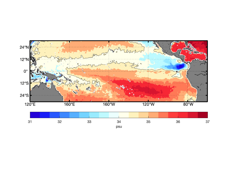
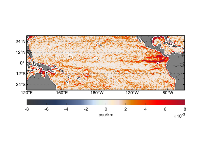
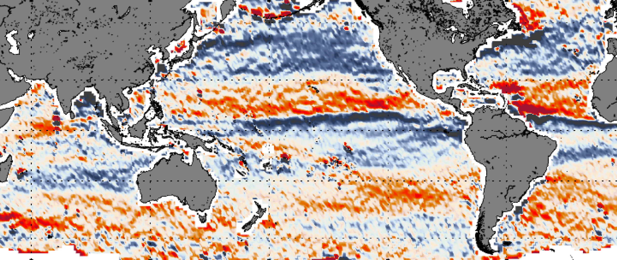
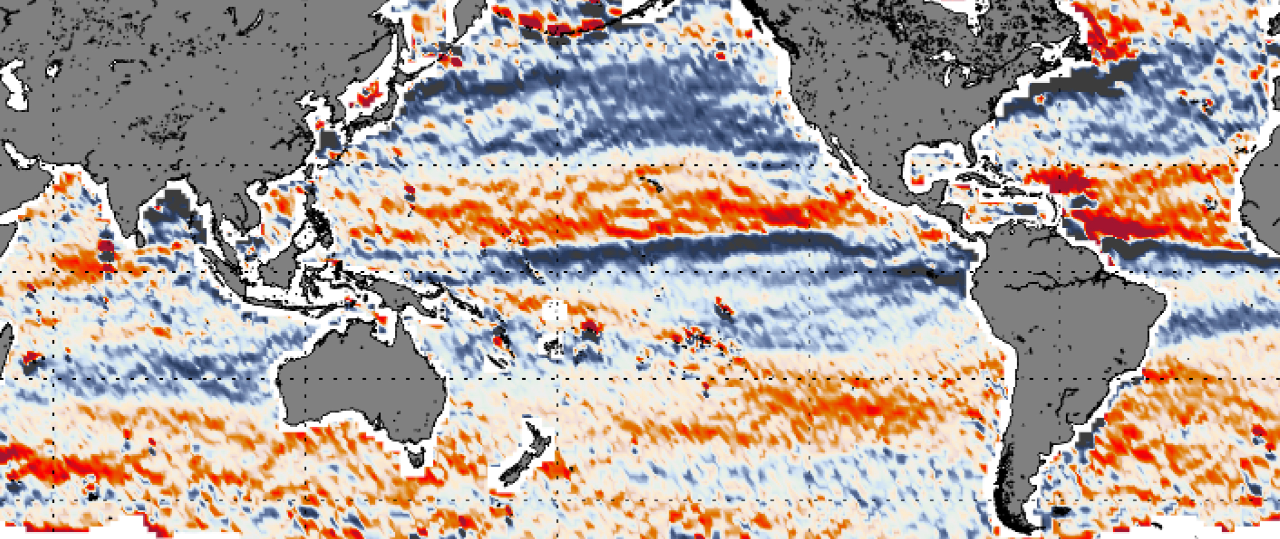
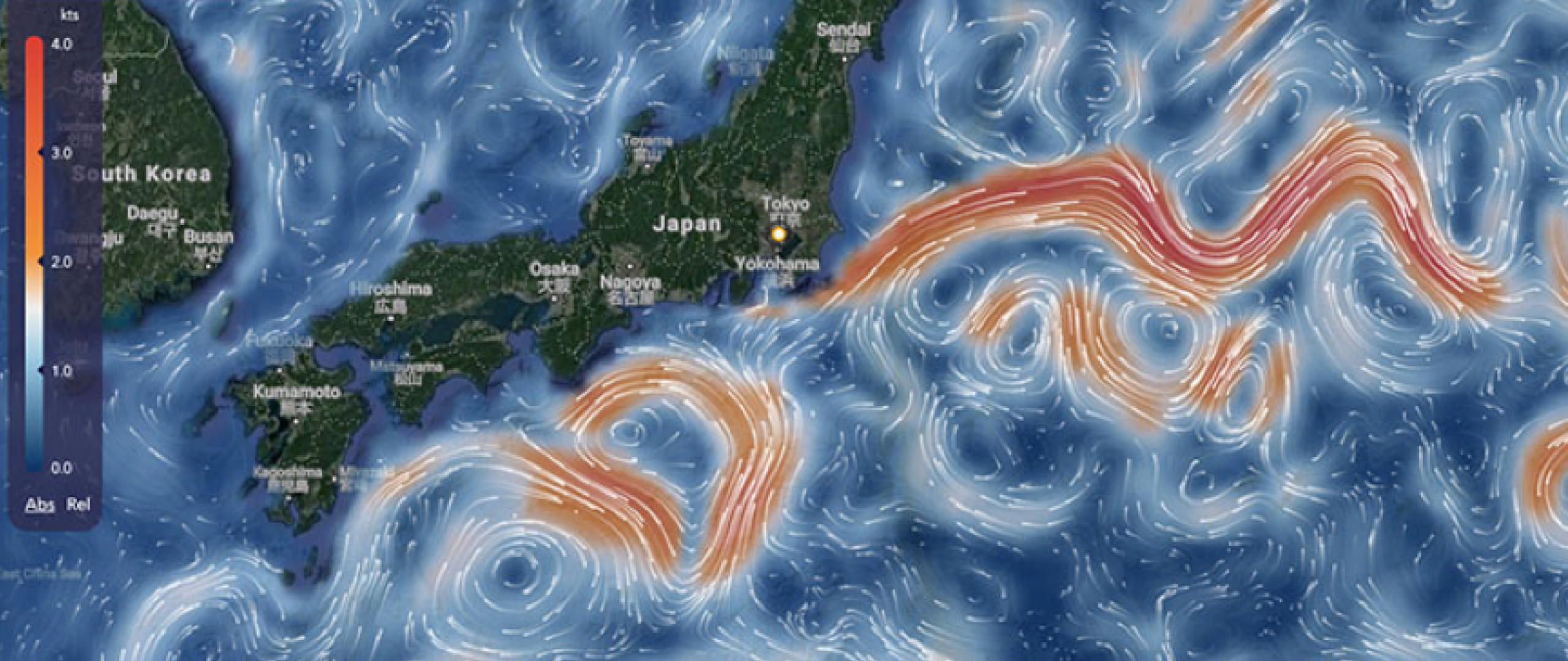
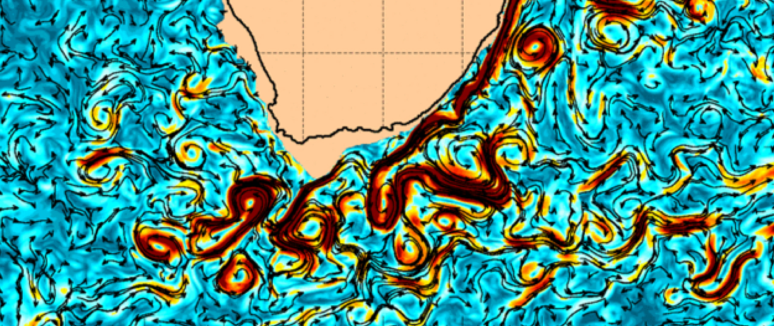
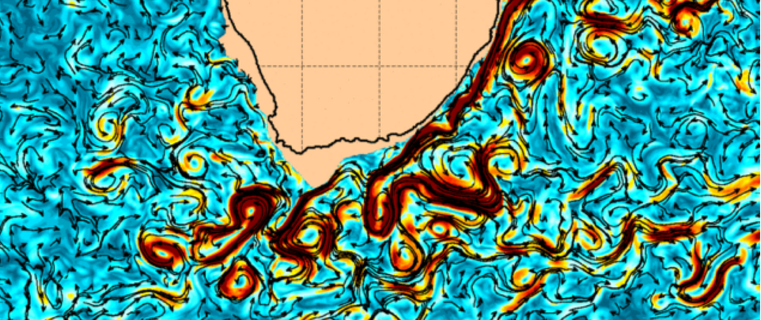
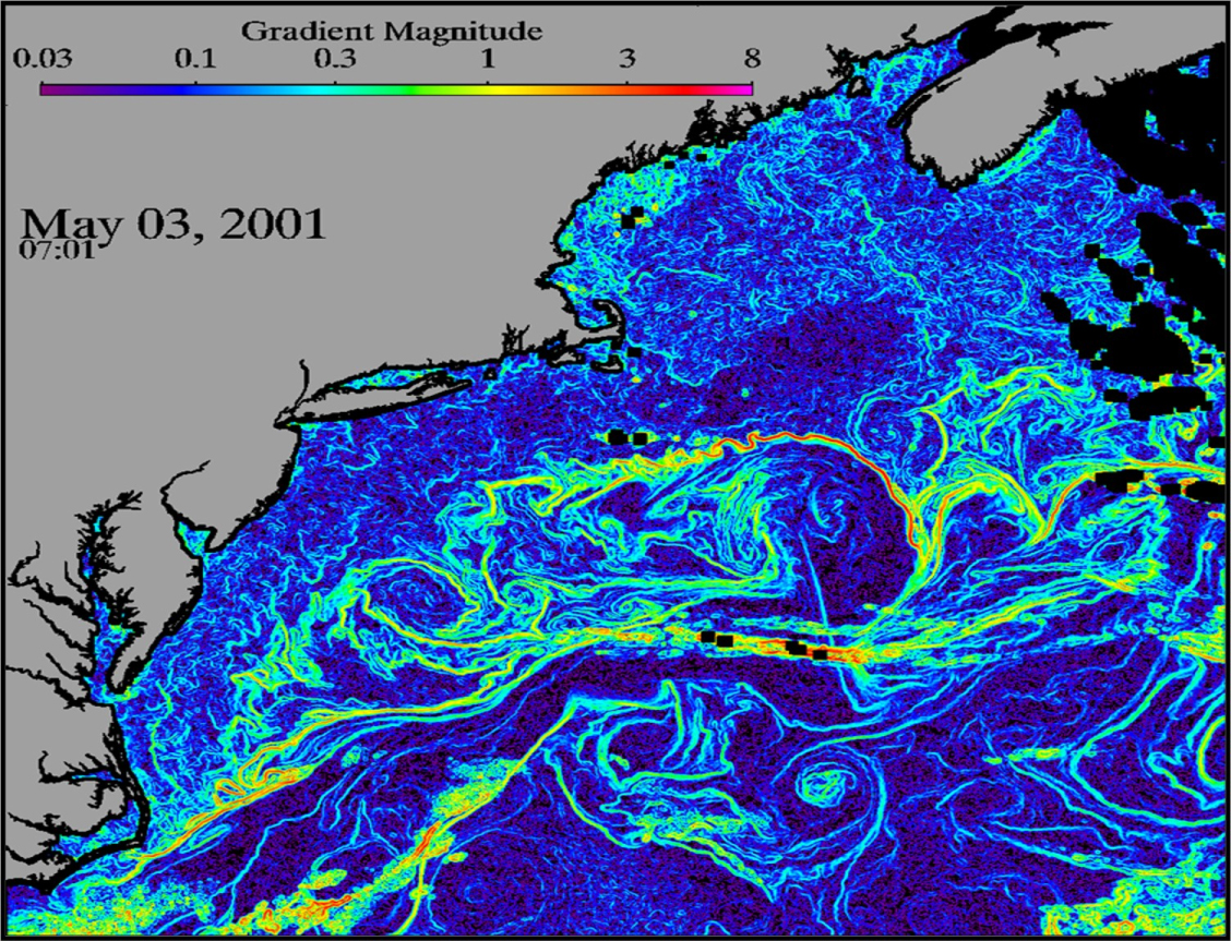
Ocean fronts can form where water masses collide. Defined by stark changes in temperature or salinity, these liquid boundaries can concentrate nutrients and enhance productivity. Living creatures seek out these oceanic features as habitats of choice for foraging, reproduction, recruitment, and migration.

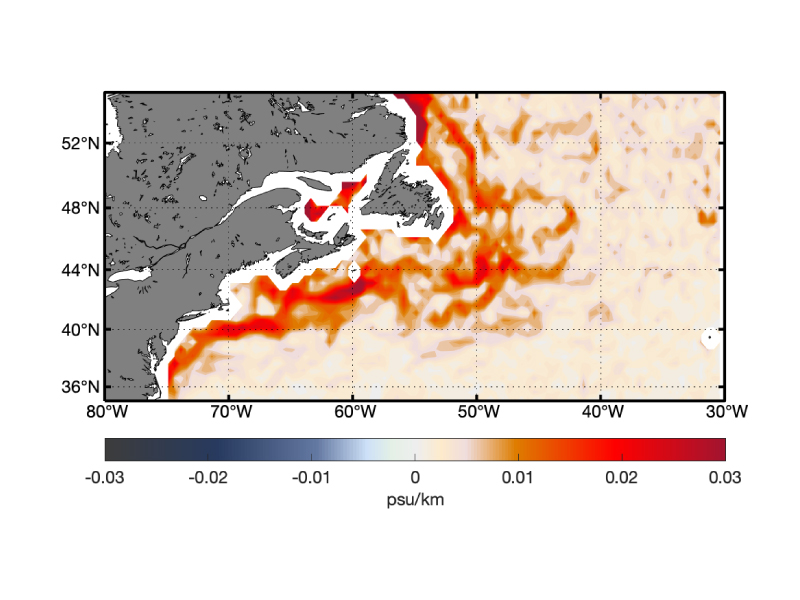
Fronts and other mesoscale features such as eddies have been recognized as ecologically important by marine biologists – and by some in the fishing industry – for many years. In addition, fine-scale salinity gradients are useful for tracking of climate-relevant ocean motions such as tropical instability waves and the meandering of the Gulf Stream.

Until recently, the use of satellite data in everyday activities and long-term planning of marine fisheries has been limited. This situation has changed quite dramatically in the past decade: maps are now routinely generated by new computer algorithms that can detect fronts of various oceanic properties from satellite data.

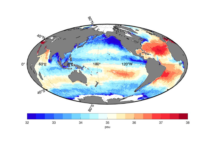
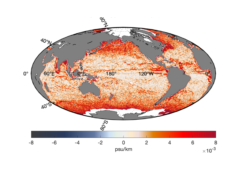
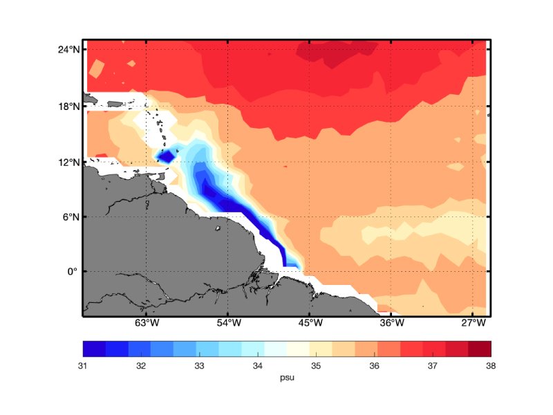
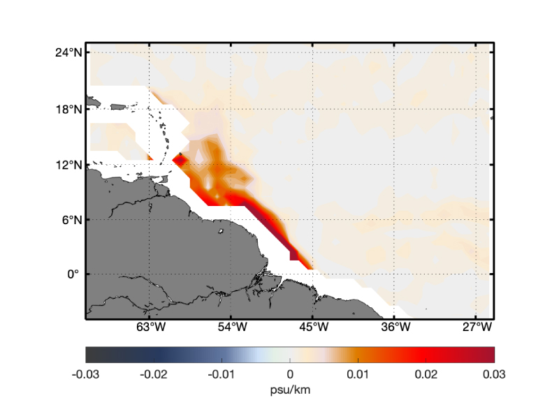
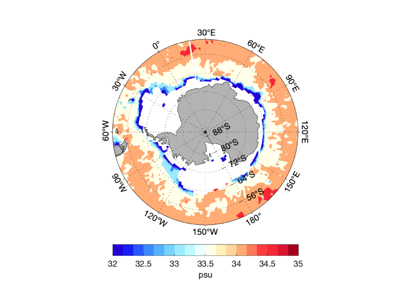
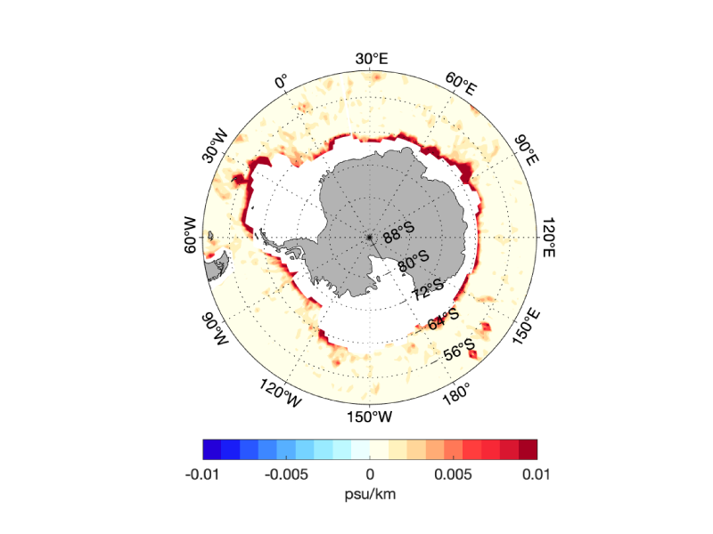
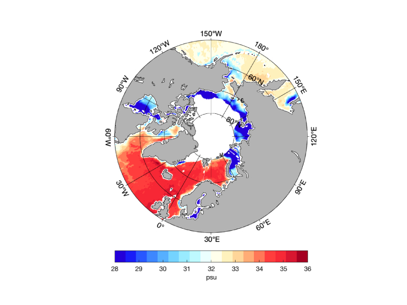
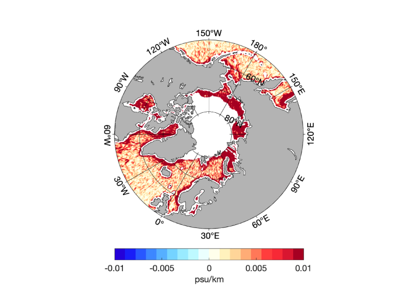
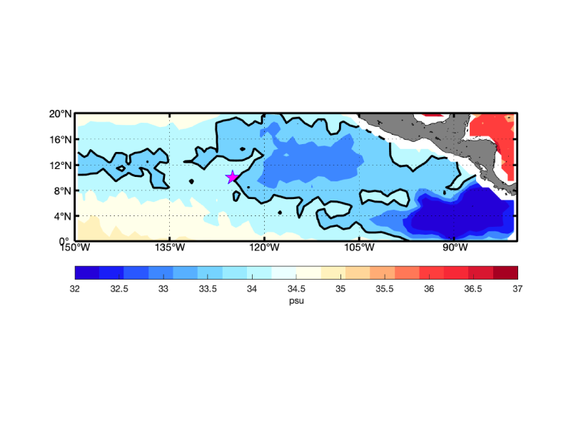
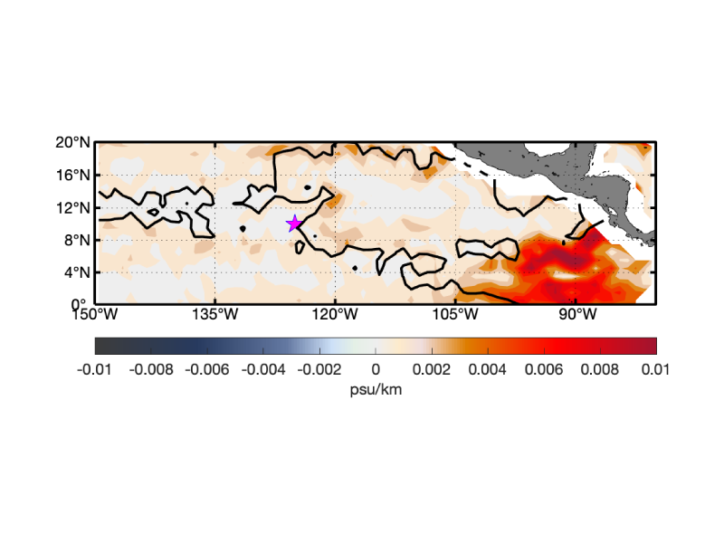
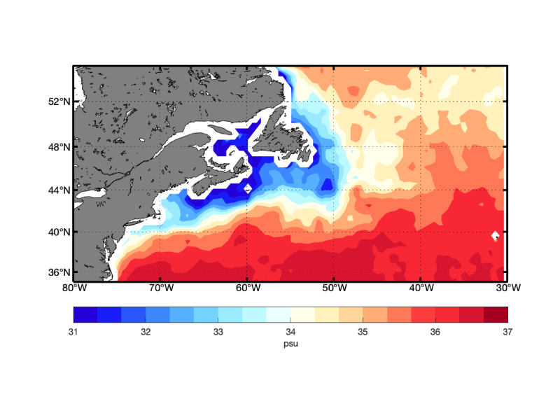
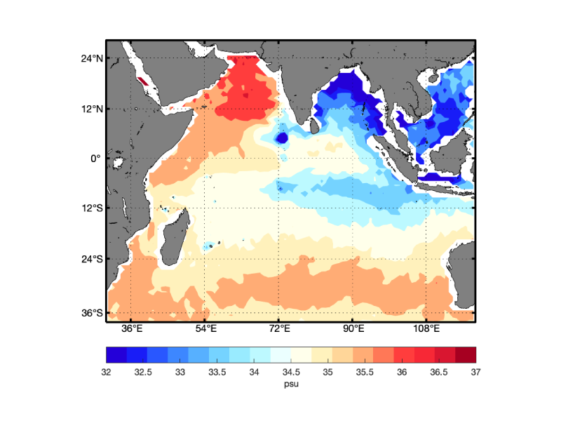
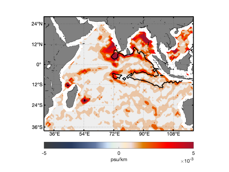
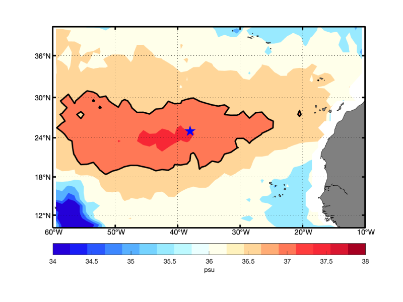
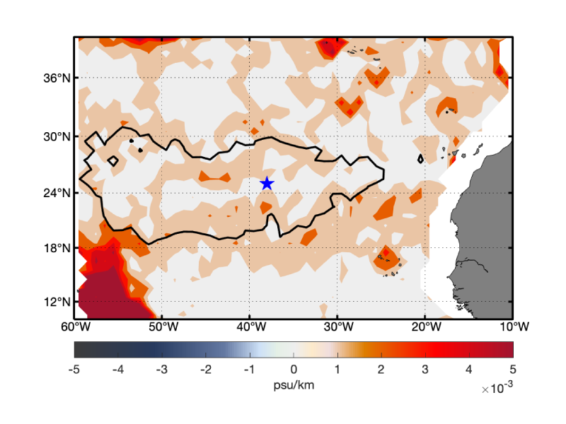
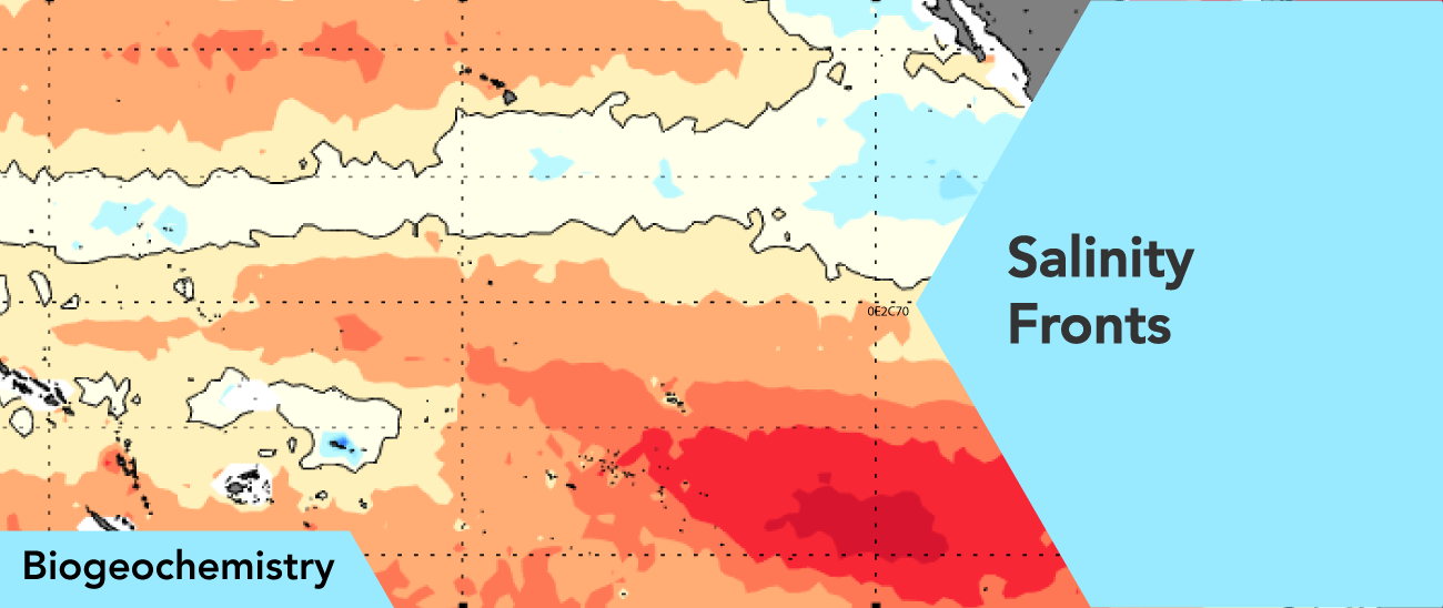
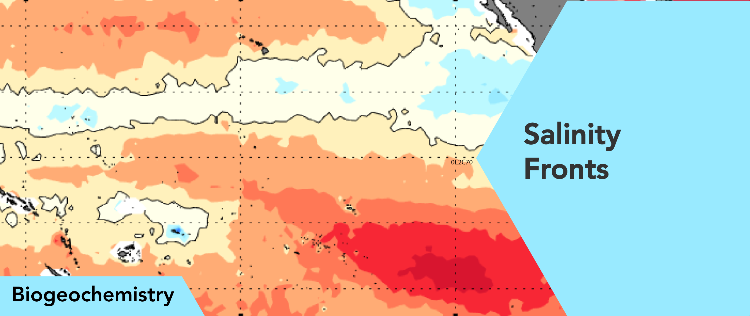
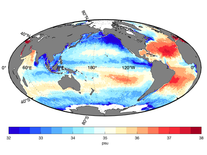
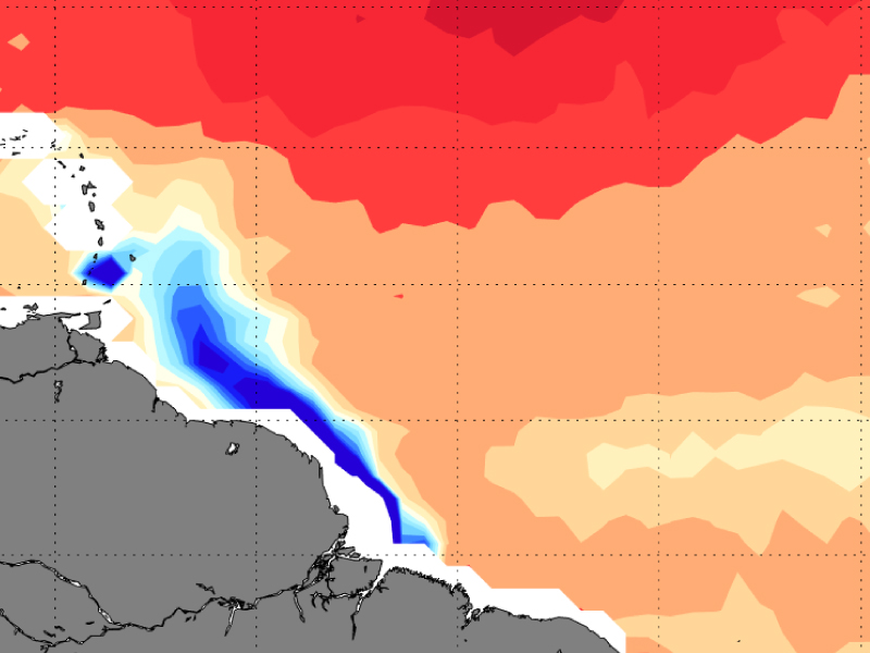
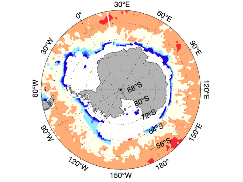
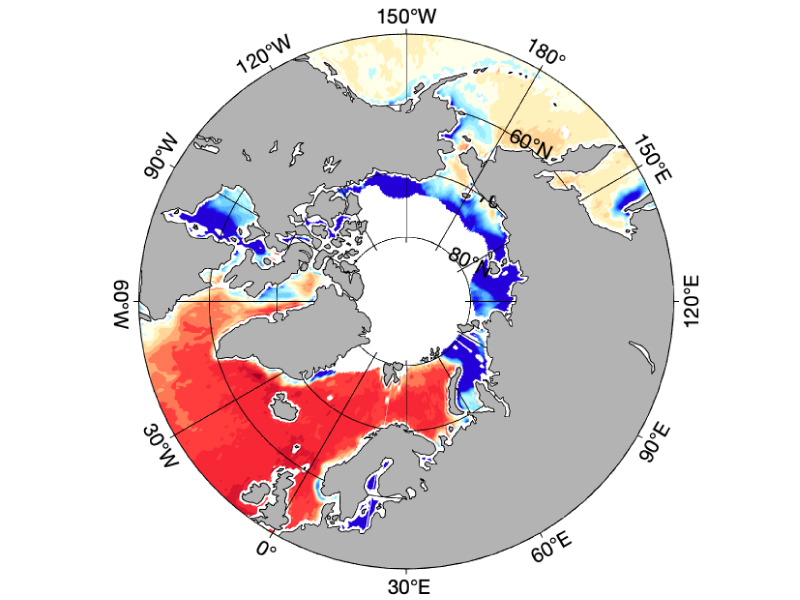
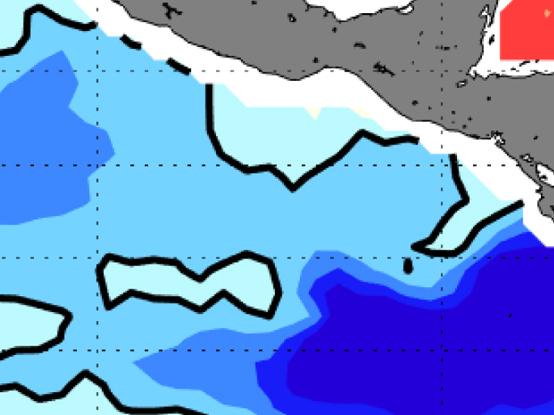
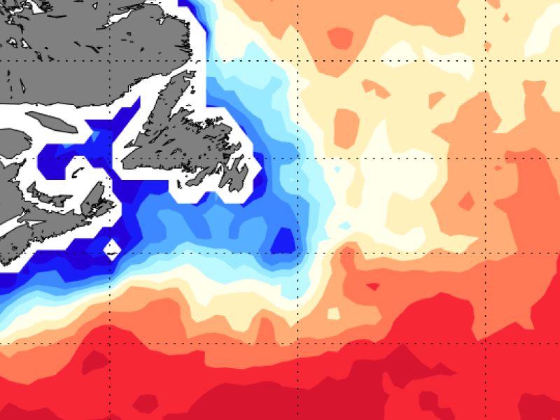
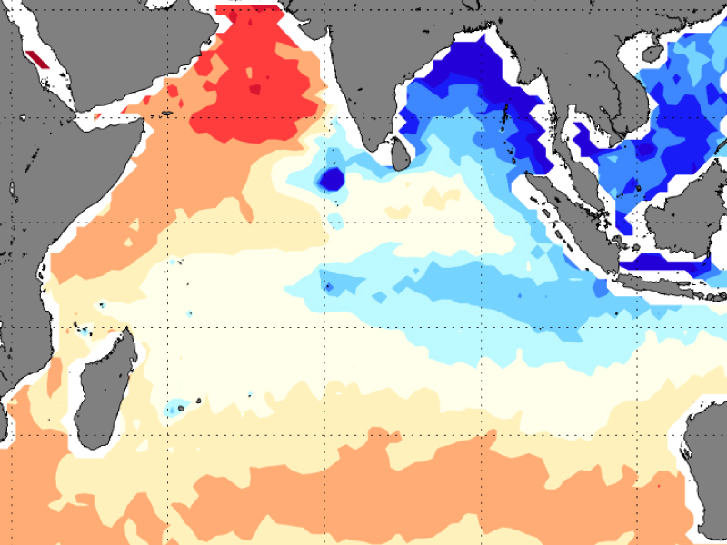
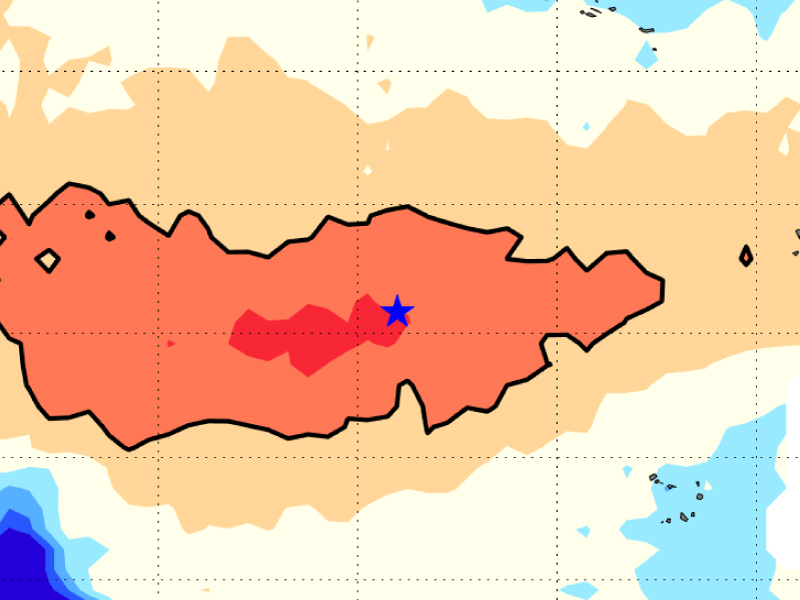
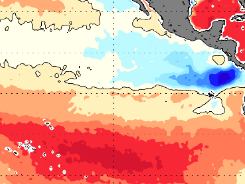
Click on the images below to compare selected maps of sea surface salinity and salinity gradients produced from satellite data by Earth & Space Research (ESR). View all maps at ESR.

Global
Global
Amazon River Plume
Amazon River Plume
Antarctic Ocean
Antarctic Ocean
Arctic Ocean
Arctic Ocean
East Tropical Pacific Ocean
Gulf Stream
Gulf Stream
Indian Ocean
Indian Ocean
Subtropical North Atlantic Ocean
Tropical Pacific Ocean

Related Publications

  • Vazquez-Cuervo, J., García-Reyes, M. and Gómez-Valdés, J. (2023). Identification of Sea Surface Temperature and Sea Surface Salinity Fronts along the California Coast: Application Using Saildrone and Satellite Derived Products, Remote Sens., 15 (2), 484, doi: 10.3390/rs15020484.
  • Essink, S., Hormann, V., Centurioni, L., and Mahadevan, A. (2022). On Characterizing Ocean Kinematics from Surface Drifters, J. Atmos. Ocean. Tech., 39 (8), 1183-1198, doi: https://doi.org/10.1175/JTECH-D-21-0068.1.
  • Belkin, I. (2021). Remote Sensing of Ocean Fronts in Marine Ecology and Fisheries, Remote Sens. 2021, 13(5), 883, doi: 10.3390/rs13050883.
  • Vazquez-Cuervo, J., Gomez-Valdes, J., and Bouali, M. (2020). Comparison of Satellite-Derived Sea Surface Temperature and Sea Surface Salinity Gradients Using the Saildrone California/Baja and North Atlantic Gulf Stream Deployments, Remote Sens., 12(11), 1839, doi: 10.3390/rs12111839.
  • Reul, N., Grodsky, S., Arias., M., Boutin, J., Catany, R., Chapron, B., D'Amico, F., Dinnat, E., Donlon, C., Fore, A., Fournier, S., Guimbard, S., Hasson, A., Kolodziejczyk, N., Lagerloef, G., Lee, T., Le Vine, D., Lindstrom, E., Maes, C., Mecklenburg, S., Meissner, T., Olmedo, E., Sabia, R., Tenerelli, J., Thouvenin-Masson, C., Turiel, A., Vergely, J., Wentz, and Yueh, S. (2020). Sea Surface Salinity Estimates from Spaceborne L-band Radiometers: An Overview of the First Decade of Observation (2010–2019), Remote Sens. Envir., 242, 111769, doi: 10.1016/j.rse.2020.111769.
To view all salinity publications, visit the publications page.

Featured Publications

Impact of oceanic fronts diagram

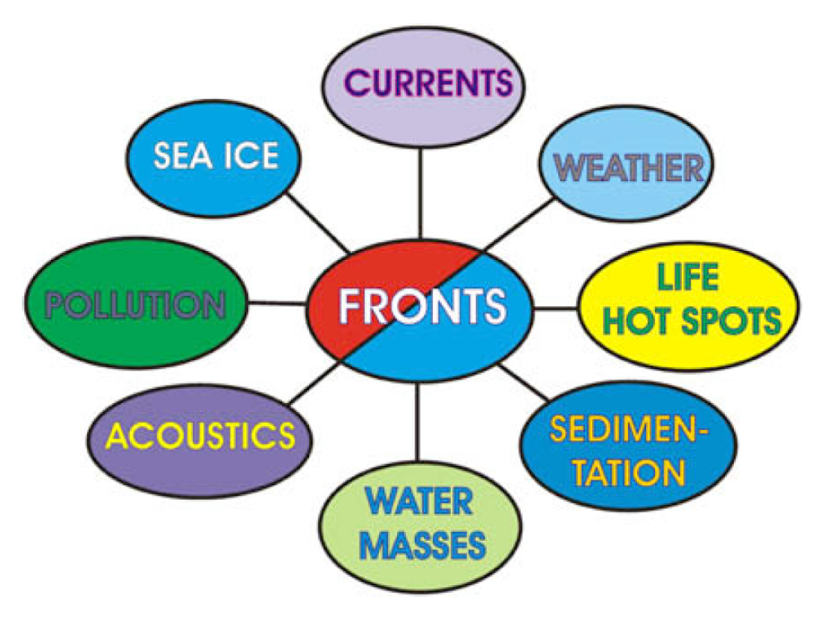
Oceanic fronts shape marine ecosystems; therefore front mapping and characterization are among the most important aspects of physical oceanography. Here the authors report on the first global remote sensing survey of fronts in large marine ecosystems.

Reference

Belkin, I.M., Cornillon, P.C., and Sherman, K. (2009). View the full paper.

Ocean fronts

This paper provides a concise review of the remote sensing of ocean fronts in marine ecology and fisheries, with a particular focus on the most popular front detection algorithms and techniques.

Reference

Belkin, I.M. (2021). View the full paper.

Global map of salinity gradient

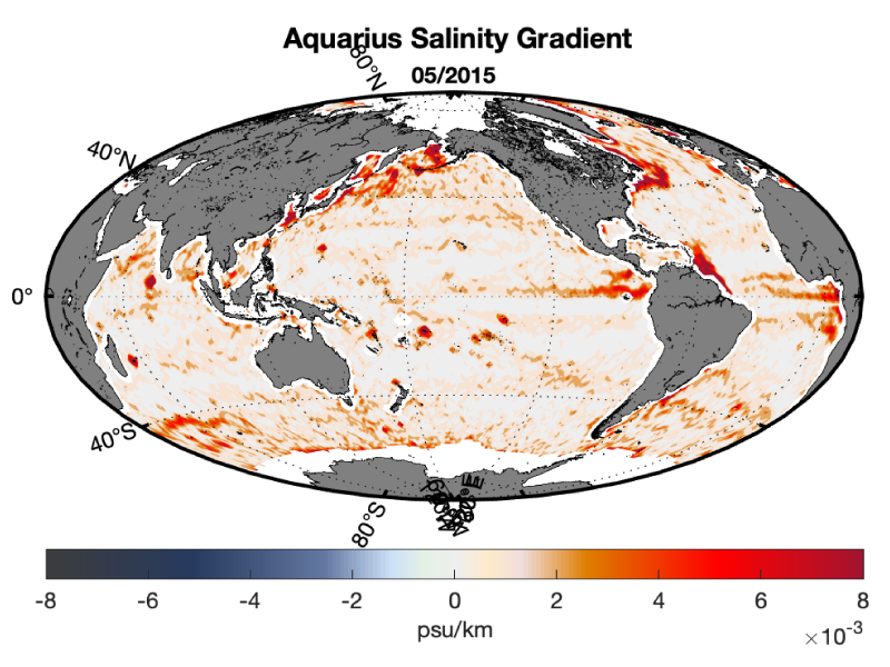
The goal of this website is to provide a systematic estimation and assessment of satellite SSS gradients over the global ocean, including spatiotemporal variability and regional analyses. Monthly data sets are provided for Aquarius, SMAP, SMAP RF, SMOS, and Argo. Daily data sets are available for Aquarius, SMAP, and SMOS.

Reference

Earth and Space Research