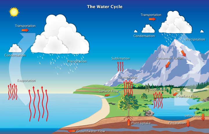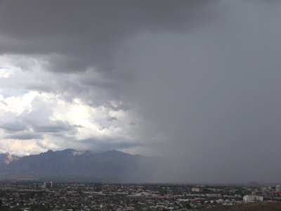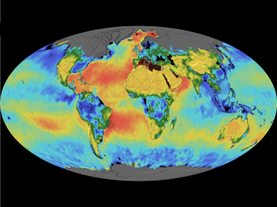


Each year, 434,000 km3 (104,000 mi3) of water evaporates into the atmosphere. About 80% of this moisture returns back into the ocean. The rest is carried over land where it can fall as rain or snow.
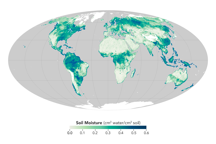
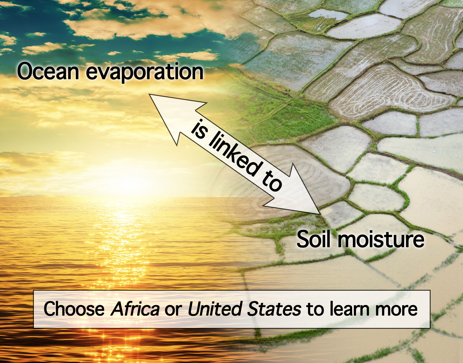
Ocean evaporation moves fresh water to the atmosphere and leaves the sea surface saltier. If an ocean region becomes saltier than normal, it is likely there will be more rain elsewhere. When precipitation occurs over land, it can increase the surface water content or its "soil moisture." Satellite sensors designed to measure ocean salinity also detect soil moisture ... and vice versa. Looking at salinity and soil moisture patterns together has revealed details of water cycle processes.
A promising approach uses satellite-derived ocean salinity to estimate rainfall on land. Why is this needed? To aid crop modeling, water resources planning, and hazards analyses. Future research will explore salinity-soil moisture connections to predict rainfall a season in advance.
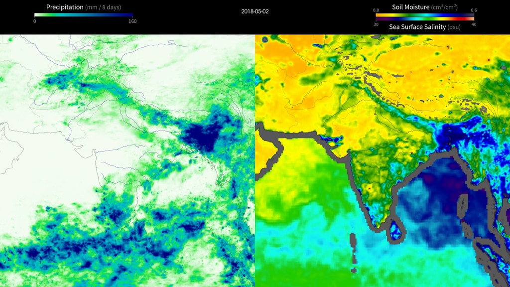
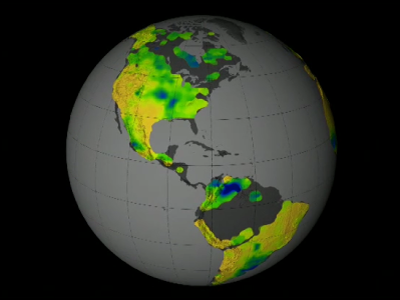
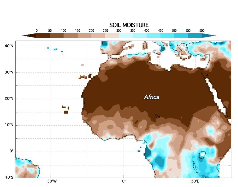
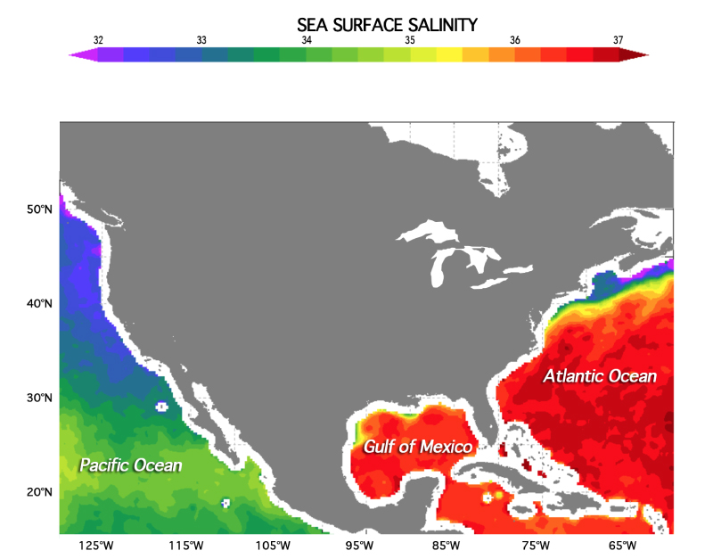
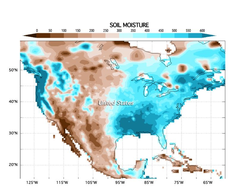
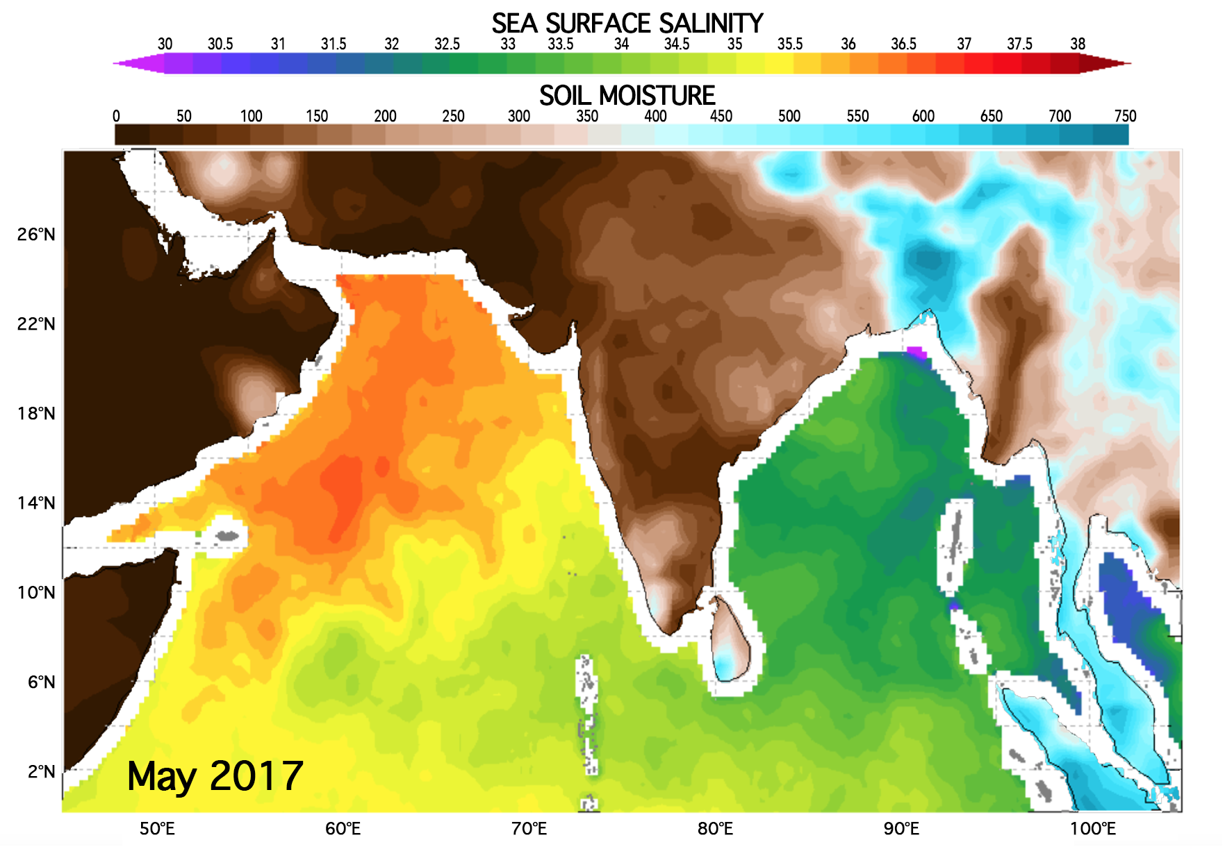
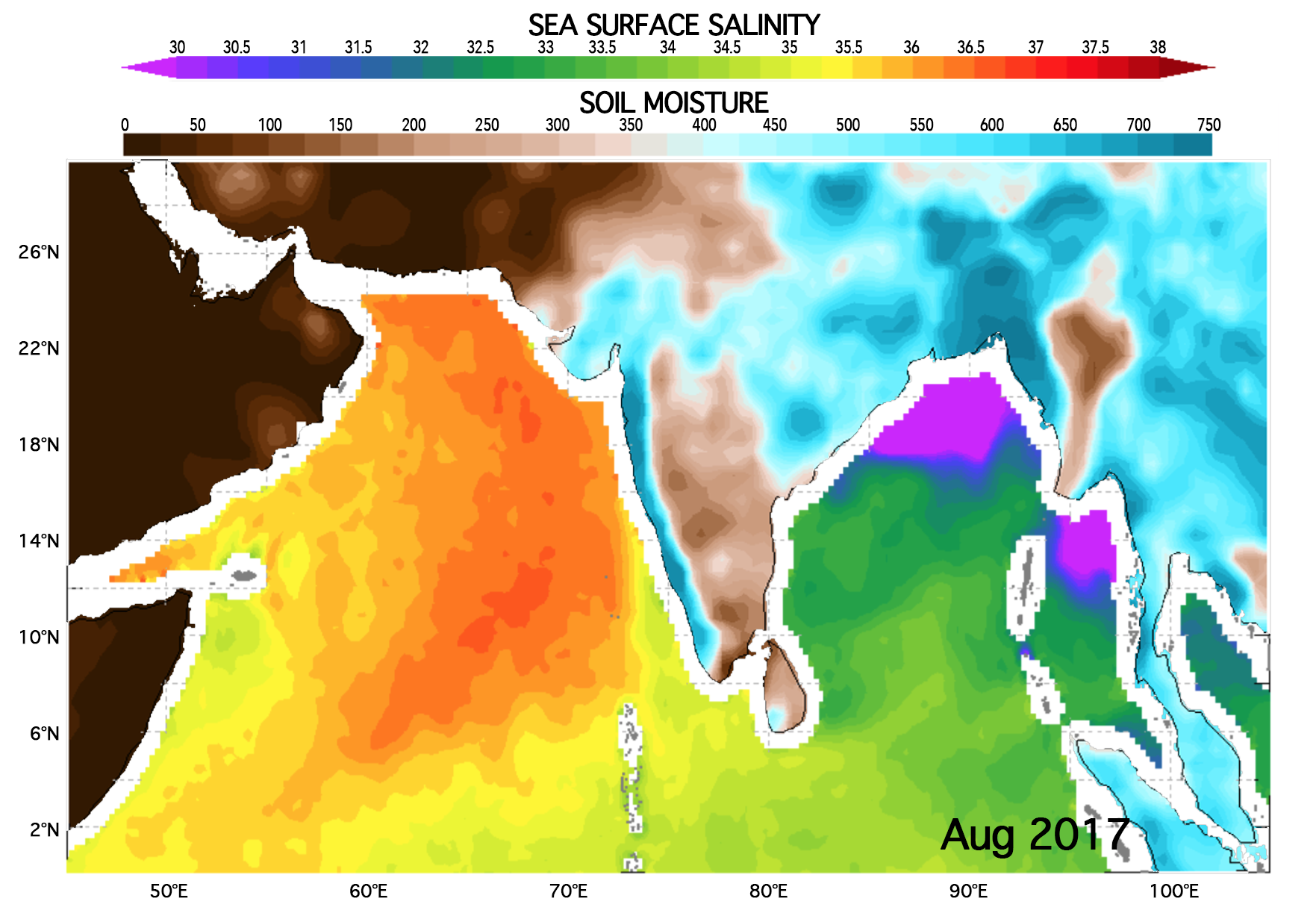
Use the tool below to investigate the link between sea surface salinity and land-based precipitation (as viewed by soil moisture, the monthly amount of water around 0-10 cm below the soil surface). Use the buttons to toggle between Africa and the United States.
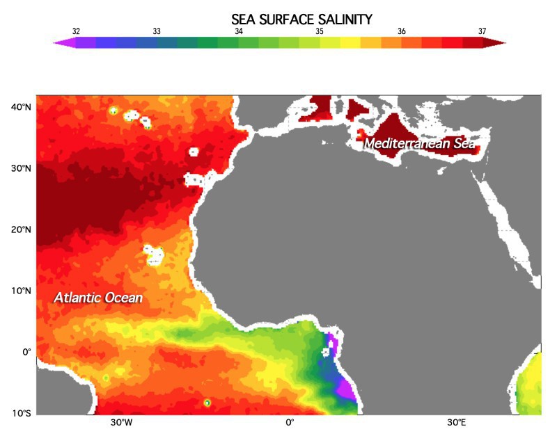
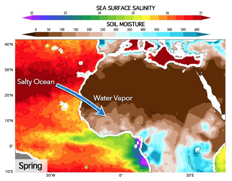

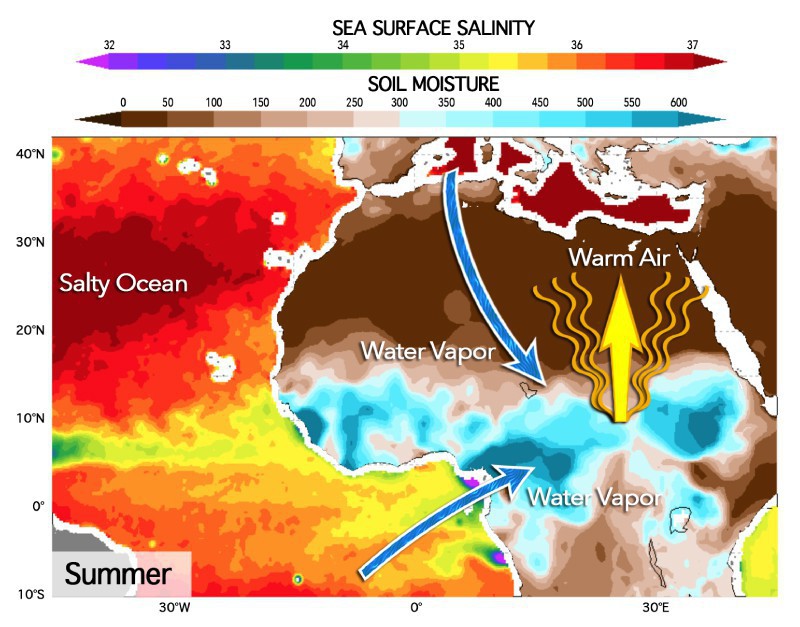
Winds evaporate water from the subtropical North Atlantic Ocean, leaving behind high levels of salinity during the spring. The exported moisture makes its way to the African Sahel, where it soaks the arid land and gradually builds up soil moisture over the course of three months. The soil moisture couples with convection in the atmosphere to create a feedback loop that draws in additional moisture from the North Atlantic and Mediterranean. This increases precipitation during the summer African monsoon season. This sequence of events has been shown by Li et al. (2016) to generally occur from Spring through Summer over many years. These figures, however, show sea surface salinity and soil moisture data from 2016. [Modified from Woods Hole Oceanographic Institution]
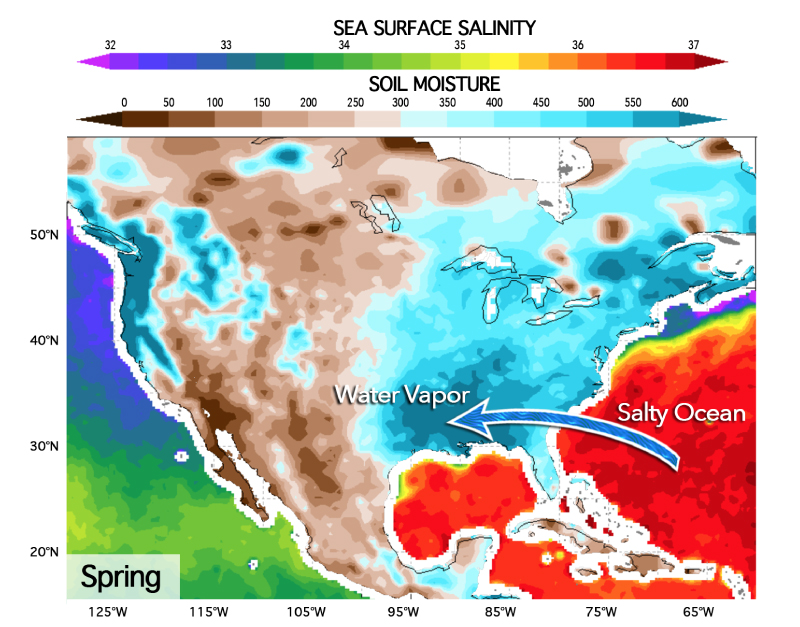
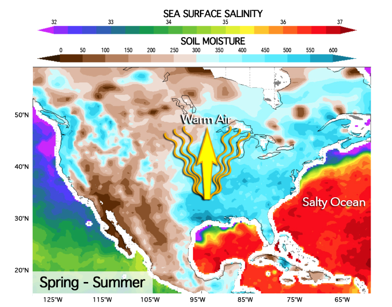
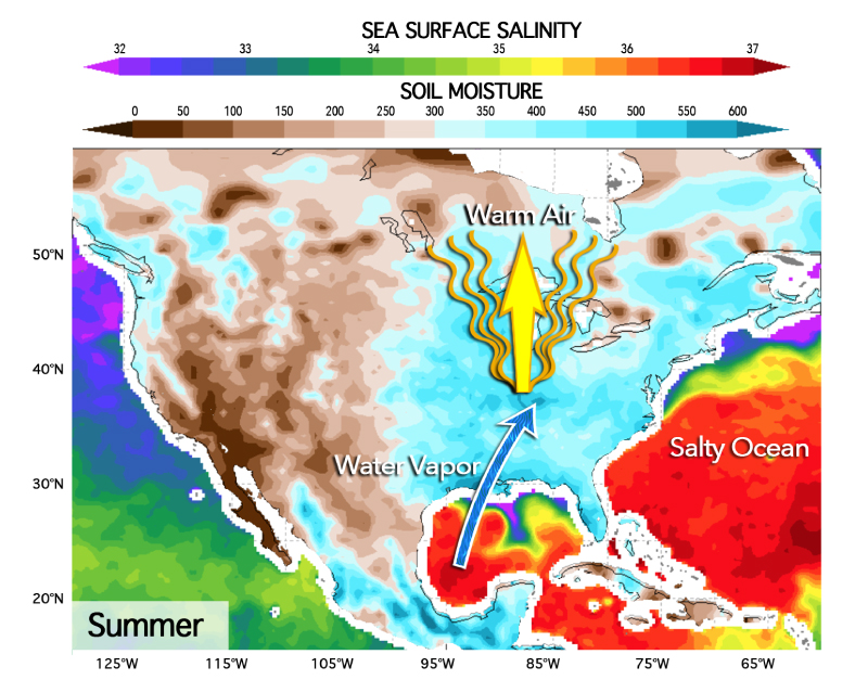
In the western North Atlantic, higher springtime salinities are an indicator of enhanced moisture export onto the continental U.S., which converges in the South. This greatly increases soil moisture there, allowing the Sun's energy to evaporate water leading to more atmospheric convection on land. The intensified convection on land draws in more moisture from the Gulf of Mexico and leads to the enhancement of the Great Plains Low Level Jet, which carries moisture to the upper Midwest in summer. [Modified from Woods Hole Oceanographic Institution]
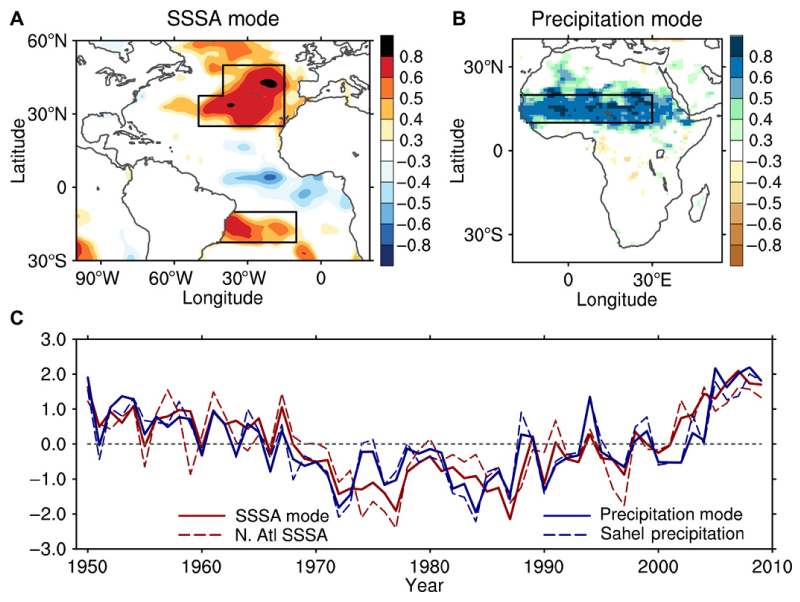
Water evaporating from the ocean sustains precipitation on land. This ocean-to-land moisture transport leaves an imprint on sea surface salinity (SSS). Thus, the question arises of whether variations in SSS can provide insight into terrestrial precipitation. This study provides evidence that springtime SSS in the subtropical North Atlantic ocean can be used as a predictor of terrestrial precipitation during the subsequent summer monsoon in Africa.
Li, L., Schmitt, R.W., Ummenhofer, C.C., and Karnauskas, K.B. (2016). Read the full paper.

The role of the oceanic water cycle in the record-breaking 2015 warm-season precipitation in the US is analyzed. The extreme precipitation started in the Southern U.S. in the spring and propagated northward to the Midwest and the Great Lakes in the summer of 2015. This seasonal evolution of precipitation anomalies represents a typical mode of variability of US warm-season precipitation. Analysis of the atmospheric moisture flux suggests that such a rainfall mode is associated with moisture export from the subtropical North Atlantic. This study suggests that preseason salinity patterns can be used for improved seasonal prediction of extreme precipitation in the Midwest.
Li, L., Scmitt, R.W., and Ummenhofer, C.C. (2017). Read the full paper.
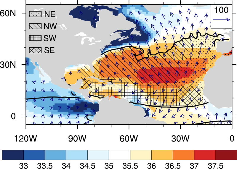
Moisture originating from the subtropical North Atlantic feeds precipitation throughout the Western Hemisphere. This ocean-to-land moisture transport leaves its imprint on sea surface salinity (SSS), enabling SSS over the subtropical oceans to be used as an indicator of terrestrial precipitation. This study demonstrates that springtime SSS over the northwestern portion of the subtropical North Atlantic significantly correlates with summertime precipitation over the U.S. Midwest.
Li, L., Schmitt, R.W., and Ummenhofer, C.C. (2016). Read the full paper.