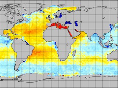
Map derived from PI-produced JPL V4.2 SMAP sea surface salinity and extreme winds dataset.
JPL SMAP Sea Surface Salinity (SSS) CAP V4.2 Dataset Released
[25-Jan-2019] DOI:
10.5067/SMP42-2NOCS |
10.5067/SMP42-2TOCS |
10.5067/SMP42-3TPCS |
10.5067/SMP42-3TMCS
The Physical Oceanography Distributed Active Archive Center (PO.DAAC) is pleased to announce the availability of the PI-produced JPL V4.2 SMAP Sea Surface Salinity (SSS) and extreme winds data, which includes Level-2B (L2B) and Level 3 (L3) standard datasets based on the JPL Combined Active-Passive (CAP) algorithm applied to data from the NASA Soil Moisture Active Passive (SMAP) observatory. Included as part of this release is also a near real-time L2B dataset, available with a latency of about 4.3 hours as a 8-day rolling store. For science applications, use of the standard products is strongly advised. We also recommend the use of the V4.2 forward stream data over the prior version, which is deprecated and will be retired within the next 6 months.
SMAP SSS V4.2 accommodates changes in the underlying Level 1B-TB data resulting from the
SMAP mission data reprocessing in June 2018. Updates with version 4.2 include: improvement in the brightness temperature (TB) calibration using an adjusted reflector emissivity, inclusion of a Sea Surface Temperature (SST) dependent flat surface emissivity model, use of updated land correction tables, and inclusion of averaged ice concentration ancillary data in the V4.2 datasets. Data begins on 1 April 2015 and is ongoing. Data sets comprising this release include the L2B orbital data and two L3 mapped, global coverage salinity datasets: an 8-day running mean dataset based on the repeat orbit of the SMAP mission, along with a monthly average dataset. The L2B data are provided on a 25 km swath grid while the L3 data are gridded at 0.25° x 0.25°. The spatial resolution of all four datasets is approximately 60 km. The L2B dataset is in HDF5 format, and the L3 datasets are in netCDF4 file format. All datasets are CF/ACDD metadata standards compliant, and include estimated SSS uncertainty fields.
The JPL SMAP-SSS CAP V4.2 datasets are described and discoverable via the
PO.DAAC data portal. The data can be accessed via PO.DAAC's public FTP site (
Level 2 and
Level 3 mapped) but preferentially via PODAAC Drive (
Level 2 and
Level 3 mapped) going forward given
deprecation of PO.DAAC's public FTP site. The data are also accessible via OPeNDAP (
Level 2 and
Level 3 mapped), and
PODAAC-WS, and are also be accessible via
THREDDS and
LAS. The SMAP Algorithm Theoretical Basis Document (ATBD), validation analysis and file specification document together with other primary technical
documentation are available from the FTP site together with
reader software. General information regarding the SMAP mission is available from the
mission website and also via PO.DAAC's
SMAP and
salinity webpages.
Citation: Fore, A.G, Yueh, S.H., Tang, W., Stiles, B.W., and Hayashi, A.K. (2016). Combined Active/Passive Retrievals of Ocean Vector Wind and Sea Surface Salinity With SMAP. IEEE TRANSACTIONS ON GEOSCIENCE AND REMOTE SENSING, VOL. 54, NO. 12. p.7396-7404. DOI: 10.1109/TGRS.2016.2601486
Comments/Questions? Please contact
podaac@podaac.jpl.nasa.gov or visit the
PO.DAAC Forum.
Important Information for UsersNASA is in the process of deprecating the use of the FTP protocol for data and information access. PO.DAAC is pleased to offer PO.DAAC Drive as a robust FTP alternative for browsing and retrieving data at PO.DAAC (
https://podaac-tools.jpl.nasa.gov/drive/). It offers file navigation and download through an interface served directly through your browser, and with a familiar look and feel. It also allows users to access data via a command line so that interactions can be easily scripted. The entire PO.DAAC archive can also be mounted to a local computer as a virtual data store.