Robotic autonomous underwater vehicles (AUVs) allow scientists to magnify what can be done from a research vessel.
Humans cannot stay on site in the middle of the ocean for a year, but these robots can!
Four different types of AUVs were used on SPURS.
Three AUVs took measurements at various depths below the ocean surface, while the fourth remained at the surface.
Each collected multi-scale measurements of temperature, salinity, and other water properties.
The information from these sensors was fed back to shore where it was integrated into a coherent picture of what the ocean was doing, on scales ranging from the entire Atlantic to a single cubic centimeter.
Featured Video: Seagliders and Profilers
Dr. Lou St. Laurent discusses seagliders (with a comparison to the Slocum glider) and the vertical microstructure profiler (VMP)
(view transcript).
Types of Robotic AUVs
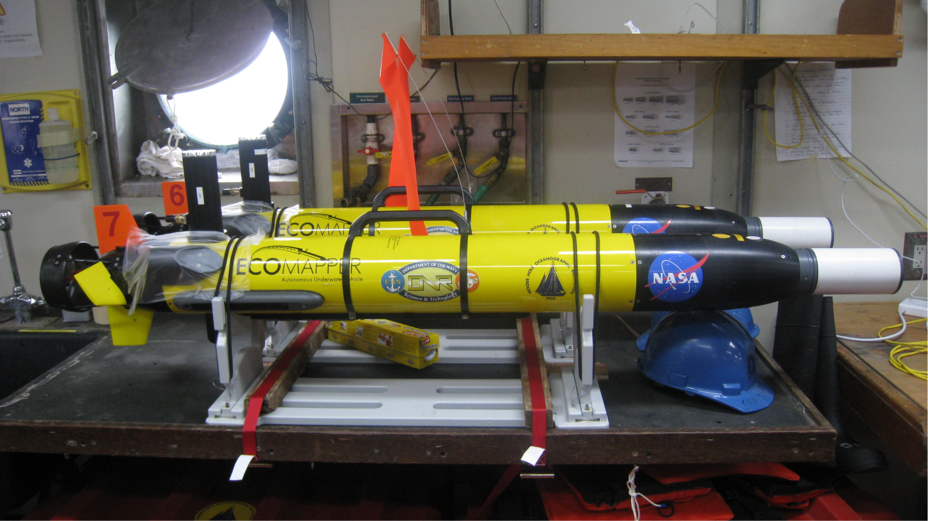
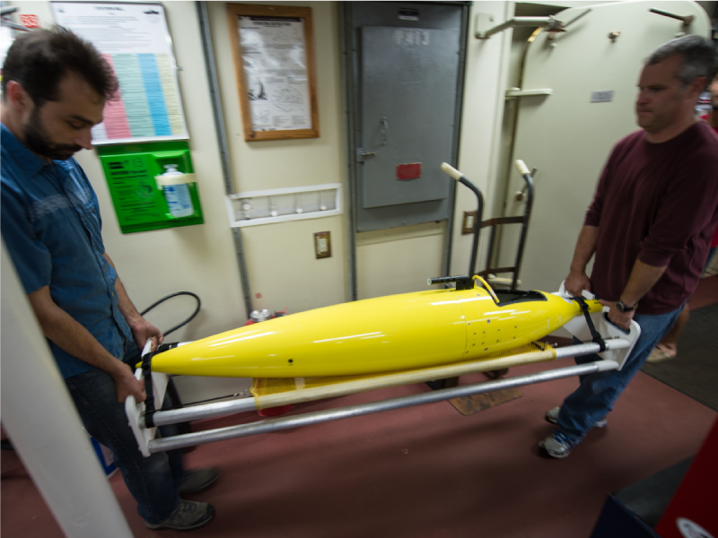
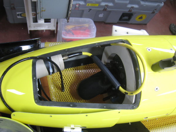
IVER 2/Eco-Mapper
What does it do? The
Eco-Mapper carries the instruments that measure the spatial structure of the upper ocean.
How does it work? The Eco-mapper is similar to a small submarine. Unlike other gliders, it is and uses energy stored on board in the form of batteries. The propellers drive the vehicle forward at 3-4 knots for 3-4 hours while the on-board instruments collect high-resolution measurements of temperature, salinity, and other water properties at scales ranging from a few kilometers to a few tens of meters.
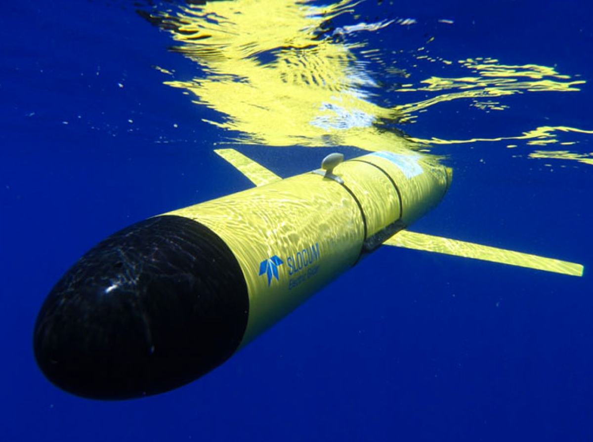
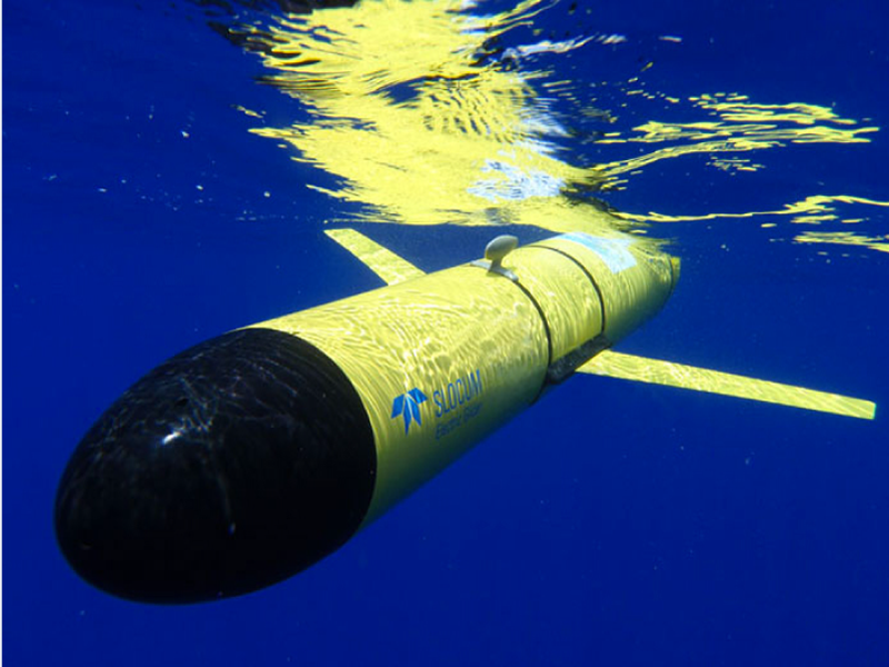
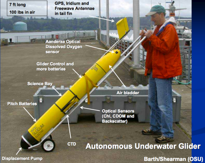
Slocum Glider
What does it do? These
gliders carry microstructure sensors that measure very fine-scale changes in salinity and temperature. They will remain in the water for several weeks while the R/V
Knorr is in the SPURS study region and will be recovered as scientists leave the area.
How does it work? A
Slocum glider is
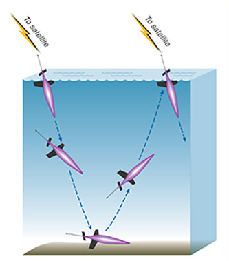
buoyancy driven and uses very little battery power. To rise, it expels water from an inside chamber (this increases buoyancy); to sink, it takes water into the chamber (this decreases buoyancy). They have rigid wings on the side to help the glider sink slowly at an angle, and no external moving parts. Data is transmitted at the surface via an iridium antenna.
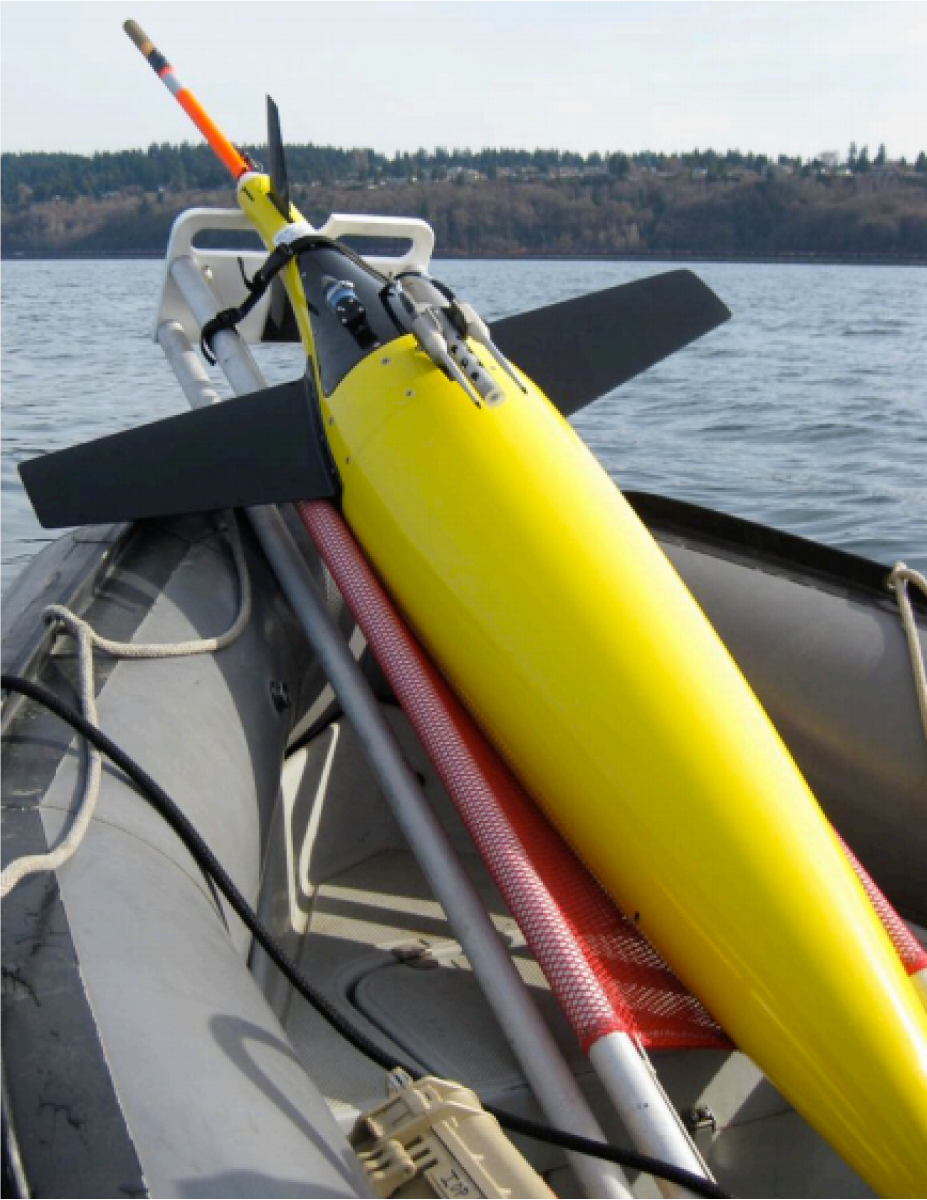
Seaglider
What does it do? Seagliders carry instruments that collect continuous measurements of temperature and salinity. Three will be deployed for six months at SPURS, then recovered and replaced with three new gliders.
How does it work? The Seaglider works similarly to a Slocum glider, changing its buoyancy to
move up and down in the water column and transmitting data at the surface via antenna. Different from the Slocum, these gliders use
oil rather than water to manipulate buoyancy. Because they will be out for so long, they will provide a continuous one-year record of temperature and salinity over a 100-150 kilometer square area of the middle Atlantic Ocean. Read more about Seagliders and the first Seaglider launch on the SPURS cruise
blog.
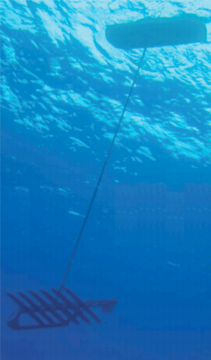
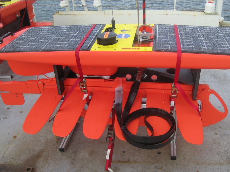
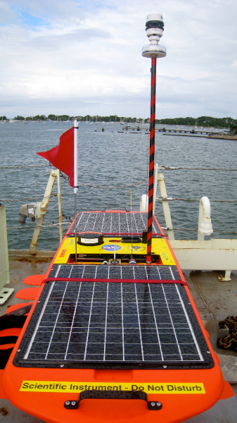
Wave Glider
What does it do? A
wave glider measures temperature and salinity while floating at the ocean surface.
How does it work? The
wave glider is an environmentally powered vehicle: surface waves provide all of the energy for forward propulsion while the electronics, sensors, and communication needs on board are powered by batteries recharged by
solar cells. Wave gliders consist of a surface platform connected to fins that dangle approximately 20 feet below the surface. These gliders will operate in the SPURS region for about a year, with minimal course corrections applied from land. The gliders call in via satellite phone about every five minutes thereby providing real-time data on near-surface ocean temperature and salinity on a continuous basis. Watch a video of a wave glider
here!


