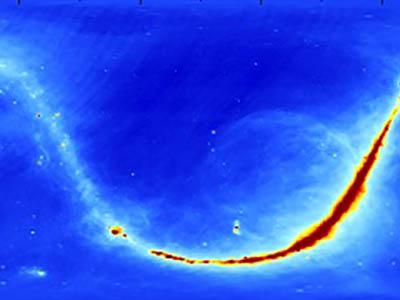
Celestial sky microwave emission map.
Aquarius Ancillary Celestial Sky Microwave Emission Map Dataset Released
[03-Jul-2018] The Physical Oceanography Distributed Active Archive Center (PO.DAAC) is pleased to announce the availability of the Aquarius celestial sky microwave emission map ancillary dataset from GSFC. This product contains three maps of L-band (wavelength = 21 cm) brightness temperature of the celestial sky used in the processing of the NASA Aquarius instrument data. The maps report sky brightness temperatures in Kelvin gridded on the Earth Centered Inertial (ECI) reference and assumed temporally invariant. These data are important for ocean remote sensing at low microwave frequencies, as in the case of sea surface salinity retrieval from Aquarius, because the sky microwave radiations reflects at the ocean surface into radiometers and introduce significant regional and seasonal errors in retrieved geophysical parameters if left uncorrected. Further information on the derivation and usage of this data product is available
here. The celestial sky microwave emission mapped dataset is provided in a single HDF5 data file with CF attributes as described in the available
users guide.
This dataset is described and discoverable via the
PO.DAAC data portal. The data can be accessed via
FTP but preferentially via
PODAAC Drive going forward given
deprecation of PO.DAAC's public FTP site. The data are also accessible via
OPeNDAP and
PODAAC-WS.